L’Étang-la-Ville geodata
L’Étang-la-Ville (Île-de-France) is a populated place; located in France in Europe/Paris (GMT+2) time zone. With population of 4,641 people, there are 2133 cities with bigger population in this country. Compared to other cities in France, 77% of cities are located further ↓South; 56.3% of cities are located further →East and 56.5% of cities have higher elevation than L’Étang-la-Ville. Note1
Administrative division(s):
- Level 1: Île-de-France
- Level 2: Yvelines
- Level 3: Arrondissement de Saint-Germain-en-Laye
- Level 4: L'Étang-la-Ville


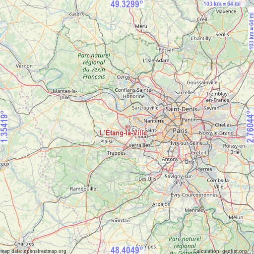
L’Étang-la-Ville GPS coordinates[2]
48° 52' 10.344" North, 2° 3' 26.352" East
| Map corner | latitude | longitude |
|---|---|---|
| Upper-left | 49.3299°, | 1.35419° |
| Center: | 48.86954°, | 2.05732° |
| Lower-right: | 48.4049°, | 2.76044° |
| Map W x H: | 102.9×102.8 km | = 63.9×63.9mi |
| max Lat: | 51.07786° ⇑23% North |
| L’Étang-la-Ville: | 48.86954° |
| min Lat: | ⇓77% South 41.3874° |
| min Long | L’Étang-la-V | max Long |
| -5.08615° | 2.05732° | 9.52242° |
| W 43.7%⇐ | ⇒56.3% E |
Elevation
Elevation of L’Étang-la-Ville is 112 m = 367 ft, and this is 81.7 m = 268 ft below average elevation for this country.
| Max E: |
2333 m = 7654 ft | 56.5% |
| Avg. | 193.7 m = 635 ft | |
| L’Étang-la-Ville | 112 m = 367 ft | |
Min E: |
-1 m = -3 ft | 43.5% |
See also: France elevation on elevation.city.
Geographical zone
L’Étang-la-Ville is located in North temperate zone (between Tropic of Cancer and the Arctic Circle). Distance of this North polar circle is 1967.4 km =1222.5 mi to North.| Distance of | km | miles | from L’Étang-la-Ville |
|---|---|---|---|
| North Pole | 4573.3 | 2841.7 | to North |
| Arctic Circle | 1967.4 | 1222.5 | to North |
| Tropic Cancer | 2827.9 | 1757.2 | to South |
| Equator | 5433.8 | 3376.4 | to South |


Nearby cities:
15 places around L’Étang-la-Ville: (largest is in red/bold)
• Aigremont
4.8 km =3 mi,  324°
324°
• Bailly
3.4 km =2.1 mi,  155°
155°
• Chambourcy
4.3 km =2.7 mi,  343°
343°
• Chavenay
5.1 km =3.2 mi,  250°
250°
• Croissy-sur-Seine
6 km =3.7 mi,  79°
79°
• Fourqueux
2 km =1.2 mi,  13°
13°
• Le Pecq
4.3 km =2.7 mi,  52°
52°
• Le Port-Marly
4.6 km =2.9 mi,  59°
59°
• Louveciennes
4.3 km =2.7 mi,  102°
102°
• Mareil-Marly
1.8 km =1.1 mi,  40°
40°
• Marly-le-Roi
1.9 km =1.2 mi, 99°
• Noisy-le-Roi
2.8 km =1.7 mi,  170°
170°
• Rocquencourt
4.8 km =3 mi,  136°
136°
• Saint-Germain-en-Laye
3.8 km =2.4 mi, 38°
• Saint-Nom-la-Bretêche
2.8 km =1.7 mi, 246°
Sources, notices
• [Note1] Compared only with cities in France existing in our database
• [Src1] Map data: © OpenStreetMap contributors (CC-BY-SA)
• [Src2] Other city data from geonames.org with taken over terms of usage.
• [Src3] Geographical zone / Annual Mean Temperature by Robert A. Rohde @ Wikipedia
