Croissy-sur-Seine geodata
Croissy-sur-Seine (Île-de-France) is a populated place; located in France in Europe/Paris (GMT+2) time zone. With population of 10,751 people, there are 891 cities with bigger population in this country. Compared to other cities in France, 77.2% of cities are located further ↓South; 55.3% of cities are located further →East and 89.1% of cities have higher elevation than Croissy-sur-Seine. Note1
Administrative division(s):
- Level 1: Île-de-France
- Level 2: Yvelines
- Level 3: Arrondissement de Saint-Germain-en-Laye
- Level 4: Croissy-sur-Seine


Croissy-sur-Seine GPS coordinates[2]
48° 52' 45.3" North, 2° 8' 18.096" East
| Map corner | latitude | longitude |
|---|---|---|
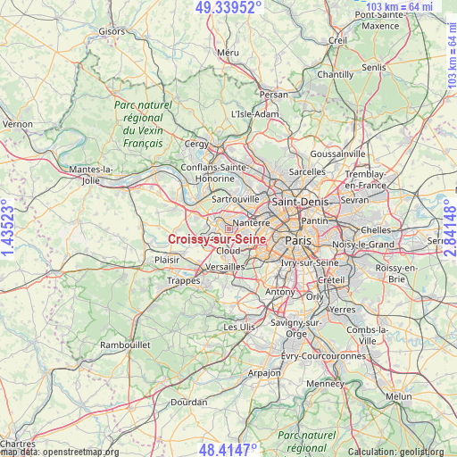
| Upper-left | 49.33952°, | 1.43523° |
| Center: | 48.87925°, | 2.13836° |
| Lower-right: | 48.4147°, | 2.84148° |
| Map W x H: | 102.8×102.8 km | = 63.9×63.9mi |
| max Lat: | 51.07786° ⇑22.8% North |
| Croissy-sur-Seine: | 48.87925° |
| min Lat: | ⇓77.2% South 41.3874° |
| min Long | Croissy-sur-Sei | max Long |
| -5.08615° | 2.13836° | 9.52242° |
| W 44.7%⇐ | ⇒55.3% E |
Elevation
Elevation of Croissy-sur-Seine is 32 m = 105 ft, and this is 161.7 m = 531 ft below average elevation for this country.
| Max E: |
2333 m = 7654 ft | 89.1% |
| Avg. | 193.7 m = 635 ft | |
| Croissy-sur-Seine | 32 m = 105 ft | |
Min E: |
-1 m = -3 ft | 10.9% |
See also: France elevation on elevation.city.
Geographical zone
Croissy-sur-Seine is located in North temperate zone (between Tropic of Cancer and the Arctic Circle). Distance of this North polar circle is 1966.3 km =1221.8 mi to North.| Distance of | km | miles | from Croissy-sur-Seine |
|---|---|---|---|
| North Pole | 4572.2 | 2841 | to North |
| Arctic Circle | 1966.3 | 1221.8 | to North |
| Tropic Cancer | 2828.9 | 1757.8 | to South |
| Equator | 5434.9 | 3377.1 | to South |


Nearby cities:
15 places around Croissy-sur-Seine: (largest is in red/bold)
• Bougival
1.9 km =1.2 mi,  173°
173°
• Carrières-sur-Seine
4.3 km =2.7 mi,  44°
44°
• Chatou
1.9 km =1.2 mi,  51°
51°
• La Celle-Saint-Cloud
3.3 km =2.1 mi, 171°
• Le Pecq
3 km =1.9 mi,  301°
301°
• Le Port-Marly
2.3 km =1.4 mi, 301°
• Le Vésinet
1.6 km =1 mi,  345°
345°
• Louveciennes
2.7 km =1.7 mi,  220°
220°
• Mareil-Marly
4.8 km =3 mi,  273°
273°
• Marly-le-Roi
4.3 km =2.7 mi,  250°
250°
• Montesson
3.3 km =2.1 mi,  358°
358°
• Nanterre
5.2 km =3.2 mi,  74°
74°
• Rueil-Malmaison
3.8 km =2.4 mi,  94°
94°
• Saint-Germain-en-Laye
4 km =2.5 mi, 298°
• Vaucresson
4.5 km =2.8 mi,  162°
162°
Sources, notices
• [Note1] Compared only with cities in France existing in our database
• [Src1] Map data: © OpenStreetMap contributors (CC-BY-SA)
• [Src2] Other city data from geonames.org with taken over terms of usage.
• [Src3] Geographical zone / Annual Mean Temperature by Robert A. Rohde @ Wikipedia
