Bailly geodata
Bailly (Île-de-France) is a populated place; located in France in Europe/Paris (GMT+2) time zone. With population of 4,300 people, there are 2292 cities with bigger population in this country. Compared to other cities in France, 76.4% of cities are located further ↓South; 56.1% of cities are located further →East and 54.2% of cities have lower elevation than Bailly. Note1
Administrative division(s):
- Level 1: Île-de-France
- Level 2: Yvelines
- Level 3: Arrondissement de Versailles
- Level 4: Bailly


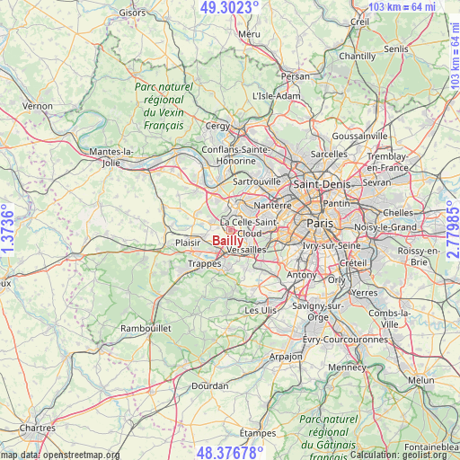
Bailly GPS coordinates[2]
48° 50' 30.048" North, 2° 4' 36.228" East
| Map corner | latitude | longitude |
|---|---|---|
| Upper-left | 49.3023°, | 1.3736° |
| Center: | 48.84168°, | 2.07673° |
| Lower-right: | 48.37678°, | 2.77985° |
| Map W x H: | 102.9×102.9 km | = 63.9×63.9mi |
| max Lat: | 51.07786° ⇑23.6% North |
| Bailly: | 48.84168° |
| min Lat: | ⇓76.4% South 41.3874° |
| min Long | Bailly | max Long |
| -5.08615° | 2.07673° | 9.52242° |
| W 43.9%⇐ | ⇒56.1% E |
Elevation
Elevation of Bailly is 147 m = 482 ft, and this is 46.7 m = 153 ft below average elevation for this country.
| Max E: |
2333 m = 7654 ft | 45.8% |
| Avg. | 193.7 m = 635 ft | |
| Bailly | 147 m = 482 ft | |
Min E: |
-1 m = -3 ft | 54.2% |
See also: France elevation on elevation.city.
Geographical zone
Bailly is located in North temperate zone (between Tropic of Cancer and the Arctic Circle). Distance of this North polar circle is 1970.5 km =1224.4 mi to North.| Distance of | km | miles | from Bailly |
|---|---|---|---|
| North Pole | 4576.4 | 2843.6 | to North |
| Arctic Circle | 1970.5 | 1224.4 | to North |
| Tropic Cancer | 2824.8 | 1755.2 | to South |
| Equator | 5430.7 | 3374.5 | to South |


Nearby cities:
15 places around Bailly: (largest is in red/bold)
• Bougival
5.3 km =3.3 mi,  64°
64°
• Fontenay-le-Fleury
3.8 km =2.4 mi,  212°
212°
• Fourqueux
5.1 km =3.2 mi,  349°
349°
• La Celle-Saint-Cloud
5.1 km =3.2 mi,  79°
79°
• Le Chesnay
4 km =2.5 mi,  123°
123°
• Le Port-Marly
6 km =3.7 mi,  25°
25°
• Louveciennes
3.5 km =2.2 mi,  52°
52°
• L’Étang-la-Ville
3.4 km =2.1 mi,  335°
335°
• Mareil-Marly
4.5 km =2.8 mi,  357°
357°
• Marly-le-Roi
2.8 km =1.7 mi,  9°
9°
• Noisy-le-Roi
1 km =0.6 mi,  287°
287°
• Rocquencourt
1.9 km =1.2 mi,  102°
102°
• Saint-Cyr-l’École
4.8 km =3 mi,  187°
187°
• Saint-Nom-la-Bretêche
4.4 km =2.7 mi,  296°
296°
• Vaucresson
5.8 km =3.6 mi,  90°
90°
Sources, notices
• [Note1] Compared only with cities in France existing in our database
• [Src1] Map data: © OpenStreetMap contributors (CC-BY-SA)
• [Src2] Other city data from geonames.org with taken over terms of usage.
• [Src3] Geographical zone / Annual Mean Temperature by Robert A. Rohde @ Wikipedia
