Limerzel geodata
Limerzel (Brittany) is a populated place; located in France in Europe/Paris (GMT+2) time zone. With population of 1,185 people, there are 7621 cities with bigger population in this country. Compared to other cities in France, 53.2% of cities are located further ↓South; 95.9% of cities are located further →East and 76.6% of cities have higher elevation than Limerzel. Note1
Administrative division(s):
- Level 1: Brittany
- Level 2: Morbihan
- Level 3: Arrondissement de Vannes
- Level 4: Limerzel


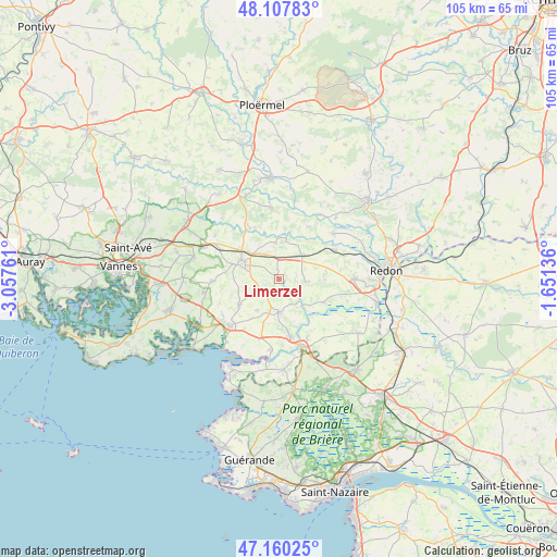
Limerzel GPS coordinates[2]
47° 38' 10.284" North, 2° 21' 16.128" West
| Map corner | latitude | longitude |
|---|---|---|
| Upper-left | 48.10783°, | -3.05761° |
| Center: | 47.63619°, | -2.35448° |
| Lower-right: | 47.16025°, | -1.65136° |
| Map W x H: | 105.4×105.4 km | = 65.5×65.5mi |
| max Lat: | 51.07786° ⇑46.8% North |
| Limerzel: | 47.63619° |
| min Lat: | ⇓53.2% South 41.3874° |
| min Long | Limerzel | max Long |
| -5.08615° | -2.35448° | 9.52242° |
| W 4.1%⇐ | ⇒95.9% E |
Elevation
Elevation of Limerzel is 63 m = 207 ft, and this is 130.7 m = 429 ft below average elevation for this country.
| Max E: |
2333 m = 7654 ft | 76.6% |
| Avg. | 193.7 m = 635 ft | |
| Limerzel | 63 m = 207 ft | |
Min E: |
-1 m = -3 ft | 23.4% |
See also: France elevation on elevation.city.
Geographical zone
Limerzel is located in North temperate zone (between Tropic of Cancer and the Arctic Circle). Distance of this North polar circle is 2104.5 km =1307.7 mi to North.| Distance of | km | miles | from Limerzel |
|---|---|---|---|
| North Pole | 4710.4 | 2926.9 | to North |
| Arctic Circle | 2104.5 | 1307.7 | to North |
| Tropic Cancer | 2690.7 | 1671.9 | to South |
| Equator | 5296.6 | 3291.2 | to South |


Nearby cities:
15 places around Limerzel: (largest is in red/bold)
• Berric
12.6 km =7.8 mi,  268°
268°
• Béganne
9.5 km =5.9 mi,  117°
117°
• Caden
5.1 km =3.2 mi,  96°
96°
• Le Guerno
7.1 km =4.4 mi,  214°
214°
• Malansac
6.4 km =4 mi,  44°
44°
• Marzan
10.9 km =6.8 mi,  168°
168°
• Molac
12.1 km =7.5 mi,  330°
330°
• Nivillac
12.6 km =7.8 mi,  154°
154°
• Noyal-Muzillac
9 km =5.6 mi,  236°
236°
• Pluherlin
6.7 km =4.2 mi,  354°
354°
• Péaule
6.3 km =3.9 mi,  181°
181°
• Questembert
7.9 km =4.9 mi,  292°
292°
• Rochefort-en-Terre
7.3 km =4.5 mi,  12°
12°
• Saint-Gravé
11.4 km =7.1 mi,  29°
29°
• Saint-Jacut-les-Pins
11.8 km =7.3 mi,  62°
62°
Sources, notices
• [Note1] Compared only with cities in France existing in our database
• [Src1] Map data: © OpenStreetMap contributors (CC-BY-SA)
• [Src2] Other city data from geonames.org with taken over terms of usage.
• [Src3] Geographical zone / Annual Mean Temperature by Robert A. Rohde @ Wikipedia
