Caden geodata
Caden (Brittany) is a populated place; located in France in Europe/Paris (GMT+2) time zone. With population of 1,521 people, there are 6113 cities with bigger population in this country. Compared to other cities in France, 53.1% of cities are located further ↓South; 95.8% of cities are located further →East and 73.1% of cities have higher elevation than Caden. Note1
Administrative division(s):
- Level 1: Brittany
- Level 2: Morbihan
- Level 3: Arrondissement de Vannes
- Level 4: Caden


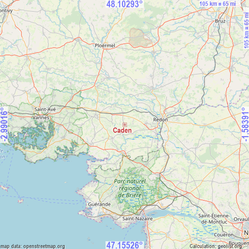
Caden GPS coordinates[2]
47° 37' 52.464" North, 2° 17' 13.344" West
| Map corner | latitude | longitude |
|---|---|---|
| Upper-left | 48.10293°, | -2.99016° |
| Center: | 47.63124°, | -2.28704° |
| Lower-right: | 47.15526°, | -1.58391° |
| Map W x H: | 105.4×105.4 km | = 65.5×65.5mi |
| max Lat: | 51.07786° ⇑46.9% North |
| Caden: | 47.63124° |
| min Lat: | ⇓53.1% South 41.3874° |
| min Long | Caden | max Long |
| -5.08615° | -2.28704° | 9.52242° |
| W 4.2%⇐ | ⇒95.8% E |
Elevation
Elevation of Caden is 71 m = 233 ft, and this is 122.7 m = 403 ft below average elevation for this country.
| Max E: |
2333 m = 7654 ft | 73.1% |
| Avg. | 193.7 m = 635 ft | |
| Caden | 71 m = 233 ft | |
Min E: |
-1 m = -3 ft | 26.9% |
See also: France elevation on elevation.city.
Geographical zone
Caden is located in North temperate zone (between Tropic of Cancer and the Arctic Circle). Distance of this North polar circle is 2105.1 km =1308 mi to North.| Distance of | km | miles | from Caden |
|---|---|---|---|
| North Pole | 4711 | 2927.3 | to North |
| Arctic Circle | 2105.1 | 1308 | to North |
| Tropic Cancer | 2690.2 | 1671.6 | to South |
| Equator | 5296.1 | 3290.8 | to South |


Nearby cities:
15 places around Caden: (largest is in red/bold)
• Allaire
9.3 km =5.8 mi,  85°
85°
• Béganne
5.1 km =3.2 mi,  138°
138°
• La Roche-Bernard
12.5 km =7.8 mi,  184°
184°
• Le Guerno
10.5 km =6.5 mi,  239°
239°
• Limerzel
5.1 km =3.2 mi,  276°
276°
• Malansac
5.2 km =3.2 mi,  352°
352°
• Marzan
10.5 km =6.5 mi,  195°
195°
• Nivillac
10.8 km =6.7 mi, 178°
• Peillac
10.5 km =6.5 mi,  28°
28°
• Pluherlin
9.2 km =5.7 mi,  321°
321°
• Péaule
7.7 km =4.8 mi,  222°
222°
• Rochefort-en-Terre
8.4 km =5.2 mi,  335°
335°
• Saint-Gravé
10.5 km =6.5 mi,  2°
2°
• Saint-Jacut-les-Pins
8.1 km =5 mi,  41°
41°
• Saint-Jean-la-Poterie
12.2 km =7.6 mi, 87°
Sources, notices
• [Note1] Compared only with cities in France existing in our database
• [Src1] Map data: © OpenStreetMap contributors (CC-BY-SA)
• [Src2] Other city data from geonames.org with taken over terms of usage.
• [Src3] Geographical zone / Annual Mean Temperature by Robert A. Rohde @ Wikipedia
