Riscle geodata
Riscle (Occitanie) is a populated place; located in France in Europe/Paris (GMT+2) time zone. With population of 1,808 people, there are 5246 cities with bigger population in this country. Compared to other cities in France, 91.1% of cities are located further ↑North; 78.8% of cities are located further →East and 55.6% of cities have higher elevation than Riscle. Note1
Administrative division(s):
- Level 1: Occitanie
- Level 2: Gers
- Level 3: Arrondissement de Mirande
- Level 4: Riscle


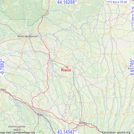
Riscle GPS coordinates[2]
43° 39' 22.788" North, 0° 5' 9.852" West
| Map corner | latitude | longitude |
|---|---|---|
| Upper-left | 44.16288°, | -0.7892° |
| Center: | 43.65633°, | -0.08607° |
| Lower-right: | 43.14547°, | 0.61705° |
| Map W x H: | 113.1×113.1 km | = 70.3×70.3mi |
| max Lat: | 51.07786° ⇑91.1% North |
| Riscle: | 43.65633° |
| min Lat: | ⇓8.9% South 41.3874° |
| min Long | Riscle | max Long |
| -5.08615° | -0.08607° | 9.52242° |
| W 21.2%⇐ | ⇒78.8% E |
Elevation
Elevation of Riscle is 115 m = 377 ft, and this is 78.7 m = 258 ft below average elevation for this country.
| Max E: |
2333 m = 7654 ft | 55.6% |
| Avg. | 193.7 m = 635 ft | |
| Riscle | 115 m = 377 ft | |
Min E: |
-1 m = -3 ft | 44.4% |
See also: France elevation on elevation.city.
Geographical zone
Riscle is located in North temperate zone (between Tropic of Cancer and the Arctic Circle). Distance of this Northern Tropic circle is 2248.2 km =1397 mi to South.| Distance of | km | miles | from Riscle |
|---|---|---|---|
| North Pole | 5152.9 | 3201.9 | to North |
| Arctic Circle | 2547 | 1582.6 | to North |
| Tropic Cancer | 2248.2 | 1397 | to South |
| Equator | 4854.1 | 3016.2 | to South |


Nearby cities:
15 places around Riscle: (largest is in red/bold)
• Aignan
14.5 km =9 mi,  71°
71°
• Barcelonne-du-Gers
13.2 km =8.2 mi,  293°
293°
• Beaumarchés
15.9 km =9.9 mi,  120°
120°
• Castelnau-Rivière-Basse
9.5 km =5.9 mi,  150°
150°
• Cazères-sur-l’Adour
21.8 km =13.5 mi,  302°
302°
• Duhort-Bachen
20.4 km =12.7 mi, 291°
• Garlin
18.5 km =11.5 mi,  234°
234°
• Le Houga
15.1 km =9.4 mi,  330°
330°
• Lembeye
23 km =14.3 mi,  182°
182°
• Madiran
12.2 km =7.6 mi,  166°
166°
• Manciet
19.1 km =11.9 mi,  33°
33°
• Nogaro
12.1 km =7.5 mi,  20°
20°
• Plaisance
12.1 km =7.5 mi, 118°
• Sainte-Marie-de-Gosse
16.7 km =10.4 mi, 225°
• Viella
7.7 km =4.8 mi,  213°
213°
Sources, notices
• [Note1] Compared only with cities in France existing in our database
• [Src1] Map data: © OpenStreetMap contributors (CC-BY-SA)
• [Src2] Other city data from geonames.org with taken over terms of usage.
• [Src3] Geographical zone / Annual Mean Temperature by Robert A. Rohde @ Wikipedia
