Reffuveille geodata
Reffuveille (Normandy) is a populated place; located in France in Europe/Paris (GMT+2) time zone. With population of 507 people, there are 15105 cities with bigger population in this country. Compared to other cities in France, 72.5% of cities are located further ↓South; 89.3% of cities are located further →East and 72% of cities have lower elevation than Reffuveille. Note1
Administrative division(s):
- Level 1: Normandy
- Level 2: Manche
- Level 3: Avranches
- Level 4: Reffuveille


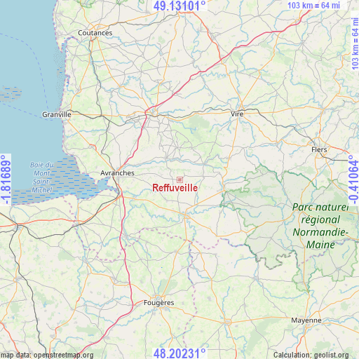
Reffuveille GPS coordinates[2]
48° 40' 7.68" North, 1° 6' 49.536" West
| Map corner | latitude | longitude |
|---|---|---|
| Upper-left | 49.13101°, | -1.81689° |
| Center: | 48.6688°, | -1.11376° |
| Lower-right: | 48.20231°, | -0.41064° |
| Map W x H: | 103.3×103.3 km | = 64.2×64.2mi |
| max Lat: | 51.07786° ⇑27.5% North |
| Reffuveille: | 48.6688° |
| min Lat: | ⇓72.5% South 41.3874° |
| min Long | Reffuveille | max Long |
| -5.08615° | -1.11376° | 9.52242° |
| W 10.7%⇐ | ⇒89.3% E |
Elevation
Elevation of Reffuveille is 230 m = 755 ft, and this is 36.3 m = 119 ft above average elevation for this country.
| Max E: |
2333 m = 7654 ft | 28% |
| Reffuveille | 230 m 755 ft | |
| Avg. | 193.7 m = 635 ft | |
Min E: |
-1 m = -3 ft | 72% |
See also: France elevation on elevation.city.
Geographical zone
Reffuveille is located in North temperate zone (between Tropic of Cancer and the Arctic Circle). Distance of this North polar circle is 1989.7 km =1236.3 mi to North.| Distance of | km | miles | from Reffuveille |
|---|---|---|---|
| North Pole | 4595.6 | 2855.6 | to North |
| Arctic Circle | 1989.7 | 1236.3 | to North |
| Tropic Cancer | 2805.5 | 1743.3 | to South |
| Equator | 5411.5 | 3362.5 | to South |


Nearby cities:
15 places around Reffuveille: (largest is in red/bold)
• Brécey
7.3 km =4.5 mi,  327°
327°
• Coulouvray-Boisbenâtre
13.1 km =8.1 mi,  1°
1°
• Ducey
14.1 km =8.8 mi,  246°
246°
• Isigny-le-Buat
7.1 km =4.4 mi,  215°
215°
• Juvigny-le-Tertre
6.8 km =4.2 mi,  82°
82°
• Le Grand-Celland
5.4 km =3.4 mi,  284°
284°
• Le Neufbourg
12.2 km =7.6 mi,  96°
96°
• Mortain
12.9 km =8 mi, 100°
• Parigny
8.6 km =5.3 mi,  162°
162°
• Romagny
11.3 km =7 mi,  106°
106°
• Saint-Hilaire-du-Harcouët
10.4 km =6.5 mi,  170°
170°
• Saint-Loup
13.4 km =8.3 mi,  269°
269°
• Saint-Pois
9.7 km =6 mi,  20°
20°
• Tirepied
12 km =7.5 mi,  292°
292°
• Virey
9.5 km =5.9 mi,  188°
188°
Sources, notices
• [Note1] Compared only with cities in France existing in our database
• [Src1] Map data: © OpenStreetMap contributors (CC-BY-SA)
• [Src2] Other city data from geonames.org with taken over terms of usage.
• [Src3] Geographical zone / Annual Mean Temperature by Robert A. Rohde @ Wikipedia
