Raon-aux-Bois geodata
Raon-aux-Bois (Grand Est) is a populated place; located in France in Europe/Paris (GMT+2) time zone. With population of 1,033 people, there are 8590 cities with bigger population in this country. Compared to other cities in France, 60.3% of cities are located further ↓South; 91.8% of cities are located further ←West and 88.9% of cities have lower elevation than Raon-aux-Bois. Note1
Administrative division(s):
- Level 1: Grand Est
- Level 2: Vosges
- Level 3: Arrondissement d’Épinal
- Level 4: Raon-aux-Bois


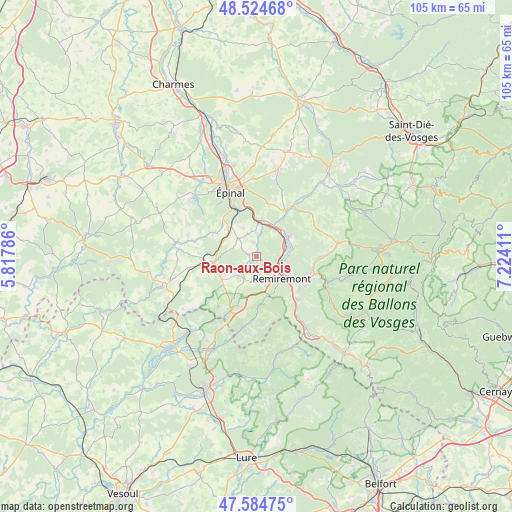
Raon-aux-Bois GPS coordinates[2]
48° 3' 24.696" North, 6° 31' 15.528" East
| Map corner | latitude | longitude |
|---|---|---|
| Upper-left | 48.52468°, | 5.81786° |
| Center: | 48.05686°, | 6.52098° |
| Lower-right: | 47.58475°, | 7.22411° |
| Map W x H: | 104.5×104.5 km | = 64.9×64.9mi |
| max Lat: | 51.07786° ⇑39.7% North |
| Raon-aux-Bois: | 48.05686° |
| min Lat: | ⇓60.3% South 41.3874° |
| min Long | Raon-aux-Bois | max Long |
| -5.08615° | 6.52098° | 9.52242° |
| W 91.8%⇐ | ⇒8.2% E |
Elevation
Elevation of Raon-aux-Bois is 405 m = 1329 ft, and this is 211.3 m = 693 ft above average elevation for this country.
| Max E: |
2333 m = 7654 ft | 11.1% |
| Raon-aux-Bois | 405 m 1329 ft | |
| Avg. | 193.7 m = 635 ft | |
Min E: |
-1 m = -3 ft | 88.9% |
See also: France elevation on elevation.city.
Geographical zone
Raon-aux-Bois is located in North temperate zone (between Tropic of Cancer and the Arctic Circle). Distance of this North polar circle is 2057.8 km =1278.7 mi to North.| Distance of | km | miles | from Raon-aux-Bois |
|---|---|---|---|
| North Pole | 4663.6 | 2897.8 | to North |
| Arctic Circle | 2057.8 | 1278.7 | to North |
| Tropic Cancer | 2737.5 | 1701 | to South |
| Equator | 5343.4 | 3320.2 | to South |


Nearby cities:
15 places around Raon-aux-Bois: (largest is in red/bold)
• Arches
6.9 km =4.3 mi,  4°
4°
• Archettes
7.5 km =4.7 mi,  9°
9°
• Bellefontaine
7.5 km =4.7 mi,  229°
229°
• Cheniménil
11 km =6.8 mi,  33°
33°
• Dommartin-lès-Remiremont
11 km =6.8 mi,  125°
125°
• Dounoux
7.8 km =4.8 mi,  313°
313°
• Hadol
4.9 km =3 mi,  318°
318°
• Pouxeux
6.7 km =4.2 mi,  35°
35°
• Remiremont
6.6 km =4.1 mi, 131°
• Saint-Amé
11.3 km =7 mi,  109°
109°
• Saint-Nabord
4.6 km =2.9 mi,  97°
97°
• Saint-Étienne-lès-Remiremont
7.5 km =4.7 mi,  120°
120°
• Uriménil
10.2 km =6.3 mi,  298°
298°
• Xertigny
8.5 km =5.3 mi,  260°
260°
• Éloyes
7.8 km =4.8 mi,  54°
54°
Sources, notices
• [Note1] Compared only with cities in France existing in our database
• [Src1] Map data: © OpenStreetMap contributors (CC-BY-SA)
• [Src2] Other city data from geonames.org with taken over terms of usage.
• [Src3] Geographical zone / Annual Mean Temperature by Robert A. Rohde @ Wikipedia
