Quistinic geodata
Quistinic (Brittany) is a populated place; located in France in Europe/Paris (GMT+2) time zone. With population of 1,337 people, there are 6873 cities with bigger population in this country. Compared to other cities in France, 57.6% of cities are located further ↓South; 97.6% of cities are located further →East and 50.6% of cities have lower elevation than Quistinic. Note1
Administrative division(s):
- Level 1: Brittany
- Level 2: Morbihan
- Level 3: Arrondissement de Lorient
- Level 4: Quistinic


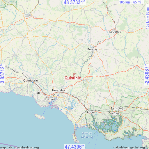
Quistinic GPS coordinates[2]
47° 54' 14.76" North, 3° 8' 2.4" West
| Map corner | latitude | longitude |
|---|---|---|
| Upper-left | 48.37331°, | -3.83712° |
| Center: | 47.9041°, | -3.134° |
| Lower-right: | 47.4306°, | -2.43087° |
| Map W x H: | 104.8×104.8 km | = 65.1×65.1mi |
| max Lat: | 51.07786° ⇑42.4% North |
| Quistinic: | 47.9041° |
| min Lat: | ⇓57.6% South 41.3874° |
| min Long | Quistinic | max Long |
| -5.08615° | -3.134° | 9.52242° |
| W 2.4%⇐ | ⇒97.6% E |
Elevation
Elevation of Quistinic is 134 m = 440 ft, and this is 59.7 m = 196 ft below average elevation for this country.
| Max E: |
2333 m = 7654 ft | 49.4% |
| Avg. | 193.7 m = 635 ft | |
| Quistinic | 134 m = 440 ft | |
Min E: |
-1 m = -3 ft | 50.6% |
See also: France elevation on elevation.city.
Geographical zone
Quistinic is located in North temperate zone (between Tropic of Cancer and the Arctic Circle). Distance of this North polar circle is 2074.7 km =1289.2 mi to North.| Distance of | km | miles | from Quistinic |
|---|---|---|---|
| North Pole | 4680.6 | 2908.4 | to North |
| Arctic Circle | 2074.7 | 1289.2 | to North |
| Tropic Cancer | 2720.5 | 1690.4 | to South |
| Equator | 5326.4 | 3309.7 | to South |


Nearby cities:
15 places around Quistinic: (largest is in red/bold)
• Baud
9.3 km =5.8 mi,  110°
110°
• Bieuzy
10.1 km =6.3 mi,  29°
29°
• Brandérion
13 km =8.1 mi,  200°
200°
• Bubry
7.1 km =4.4 mi,  337°
337°
• Calan
14.4 km =8.9 mi,  257°
257°
• Camors
11.8 km =7.3 mi,  122°
122°
• Guern
14.3 km =8.9 mi,  12°
12°
• Guénin
11.5 km =7.1 mi,  88°
88°
• Inguiniel
13.6 km =8.5 mi,  306°
306°
• La Chapelle-Neuve
15.1 km =9.4 mi, 107°
• Languidic
8.1 km =5 mi,  192°
192°
• Lanvaudan
9.5 km =5.9 mi,  266°
266°
• Melrand
8.6 km =5.3 mi, 12°
• Plouay
14.9 km =9.3 mi, 274°
• Pluméliau
13.3 km =8.3 mi,  63°
63°
Sources, notices
• [Note1] Compared only with cities in France existing in our database
• [Src1] Map data: © OpenStreetMap contributors (CC-BY-SA)
• [Src2] Other city data from geonames.org with taken over terms of usage.
• [Src3] Geographical zone / Annual Mean Temperature by Robert A. Rohde @ Wikipedia
