Plessé geodata
Plessé (Pays de la Loire) is a populated place; located in France in Europe/Paris (GMT+2) time zone. With population of 3,833 people, there are 2564 cities with bigger population in this country. Compared to other cities in France, 51.9% of cities are located further ↓South; 94.4% of cities are located further →East and 91.2% of cities have higher elevation than Plessé. Note1
Administrative division(s):
- Level 1: Pays de la Loire
- Level 2: Loire-Atlantique
- Level 3: Arrondissement of Châteaubriant-Ancenis
- Level 4: Plessé


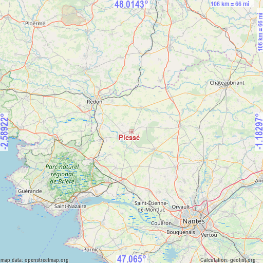
Plessé GPS coordinates[2]
47° 32' 30.48" North, 1° 53' 9.924" West
| Map corner | latitude | longitude |
|---|---|---|
| Upper-left | 48.0143°, | -2.58922° |
| Center: | 47.5418°, | -1.88609° |
| Lower-right: | 47.065°, | -1.18297° |
| Map W x H: | 105.6×105.5 km | = 65.6×65.6mi |
| max Lat: | 51.07786° ⇑48.1% North |
| Plessé: | 47.5418° |
| min Lat: | ⇓51.9% South 41.3874° |
| min Long | Plessé | max Long |
| -5.08615° | -1.88609° | 9.52242° |
| W 5.6%⇐ | ⇒94.4% E |
Elevation
Elevation of Plessé is 27 m = 89 ft, and this is 166.7 m = 547 ft below average elevation for this country.
| Max E: |
2333 m = 7654 ft | 91.2% |
| Avg. | 193.7 m = 635 ft | |
| Plessé | 27 m = 89 ft | |
Min E: |
-1 m = -3 ft | 8.8% |
See also: France elevation on elevation.city.
Geographical zone
Plessé is located in North temperate zone (between Tropic of Cancer and the Arctic Circle). Distance of this North polar circle is 2115 km =1314.2 mi to North.| Distance of | km | miles | from Plessé |
|---|---|---|---|
| North Pole | 4720.9 | 2933.4 | to North |
| Arctic Circle | 2115 | 1314.2 | to North |
| Tropic Cancer | 2680.2 | 1665.4 | to South |
| Equator | 5286.2 | 3284.7 | to South |


Nearby cities:
15 places around Plessé: (largest is in red/bold)
• Avessac
14.6 km =9.1 mi,  327°
327°
• Blain
11.8 km =7.3 mi,  128°
128°
• Bouvron
14.2 km =8.8 mi,  167°
167°
• Campbon
15.6 km =9.7 mi,  203°
203°
• Conquereuil
13.7 km =8.5 mi,  47°
47°
• Drefféac
14.9 km =9.3 mi,  239°
239°
• Fégréac
12.8 km =8 mi,  291°
291°
• Guenrouet
5.7 km =3.5 mi, 243°
• Guémené-Penfao
10.9 km =6.8 mi,  21°
21°
• Le Gâvre
10.5 km =6.5 mi,  102°
102°
• Quilly
10.3 km =6.4 mi,  209°
209°
• Saint-Gildas-des-Bois
11.7 km =7.3 mi,  255°
255°
• Sainte-Anne-sur-Brivet
12.6 km =7.8 mi,  224°
224°
• Sévérac
14.2 km =8.8 mi,  273°
273°
• Vay
14 km =8.7 mi,  84°
84°
Sources, notices
• [Note1] Compared only with cities in France existing in our database
• [Src1] Map data: © OpenStreetMap contributors (CC-BY-SA)
• [Src2] Other city data from geonames.org with taken over terms of usage.
• [Src3] Geographical zone / Annual Mean Temperature by Robert A. Rohde @ Wikipedia
