Puiseux-en-France geodata
Puiseux-en-France (Île-de-France) is a populated place; located in France in Europe/Paris (GMT+2) time zone. With population of 3,096 people, there are 3151 cities with bigger population in this country. Compared to other cities in France, 81.1% of cities are located further ↓South; 50.6% of cities are located further ←West and 56.2% of cities have higher elevation than Puiseux-en-France. Note1
Administrative division(s):
- Level 1: Île-de-France
- Level 2: Département du Val-d’Oise
- Level 3: Arrondissement de Sarcelles
- Level 4: Puiseux-en-France


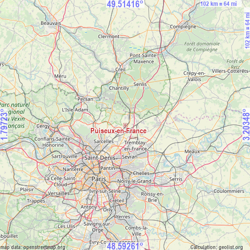
Puiseux-en-France GPS coordinates[2]
49° 3' 19.872" North, 2° 30' 1.26" East
| Map corner | latitude | longitude |
|---|---|---|
| Upper-left | 49.51416°, | 1.79723° |
| Center: | 49.05552°, | 2.50035° |
| Lower-right: | 48.59261°, | 3.20348° |
| Map W x H: | 102.5×102.5 km | = 63.7×63.7mi |
| max Lat: | 51.07786° ⇑18.9% North |
| Puiseux-en-France: | 49.05552° |
| min Lat: | ⇓81.1% South 41.3874° |
| min Long | Puiseux-en-Fran | max Long |
| -5.08615° | 2.50035° | 9.52242° |
| W 50.6%⇐ | ⇒49.4% E |
Elevation
Elevation of Puiseux-en-France is 113 m = 371 ft, and this is 80.7 m = 265 ft below average elevation for this country.
| Max E: |
2333 m = 7654 ft | 56.2% |
| Avg. | 193.7 m = 635 ft | |
| Puiseux-en-France | 113 m = 371 ft | |
Min E: |
-1 m = -3 ft | 43.8% |
See also: France elevation on elevation.city.
Geographical zone
Puiseux-en-France is located in North temperate zone (between Tropic of Cancer and the Arctic Circle). Distance of this North polar circle is 1946.7 km =1209.6 mi to North.| Distance of | km | miles | from Puiseux-en-France |
|---|---|---|---|
| North Pole | 4552.6 | 2828.9 | to North |
| Arctic Circle | 1946.7 | 1209.6 | to North |
| Tropic Cancer | 2848.5 | 1770 | to South |
| Equator | 5454.5 | 3389.3 | to South |


Nearby cities:
15 places around Puiseux-en-France: (largest is in red/bold)
• Bellefontaine
5.3 km =3.3 mi,  332°
332°
• Fontenay-en-Parisis
3.6 km =2.2 mi,  266°
266°
• Fosses
4.8 km =3 mi,  8°
8°
• Goussainville
5.3 km =3.3 mi,  208°
208°
• Le Mesnil-Aubry
7.4 km =4.6 mi, 266°
• Le Thillay
5.8 km =3.6 mi,  200°
200°
• Louvres
1.3 km =0.8 mi,  165°
165°
• Mareil-en-France
5.7 km =3.5 mi,  285°
285°
• Marly-la-Ville
3 km =1.9 mi,  4°
4°
• Moussy-le-Neuf
7.5 km =4.7 mi,  82°
82°
• Roissy-en-France
5.8 km =3.6 mi, 167°
• Saint-Witz
6.5 km =4 mi,  52°
52°
• Survilliers
5.6 km =3.5 mi,  34°
34°
• Villeron
3.1 km =1.9 mi,  85°
85°
• Vémars
5.1 km =3.2 mi,  72°
72°
Sources, notices
• [Note1] Compared only with cities in France existing in our database
• [Src1] Map data: © OpenStreetMap contributors (CC-BY-SA)
• [Src2] Other city data from geonames.org with taken over terms of usage.
• [Src3] Geographical zone / Annual Mean Temperature by Robert A. Rohde @ Wikipedia
