Prémontré geodata
Prémontré (Hauts-de-France) is a populated place; located in France in Europe/Paris (GMT+2) time zone. With population of 798 people, there are 10635 cities with bigger population in this country. Compared to other cities in France, 89.9% of cities are located further ↓South; 63.4% of cities are located further ←West and 57.3% of cities have higher elevation than Prémontré. Note1
Administrative division(s):
- Level 1: Hauts-de-France
- Level 2: Département de l'Aisne
- Level 3: Arrondissement de Laon
- Level 4: Prémontré


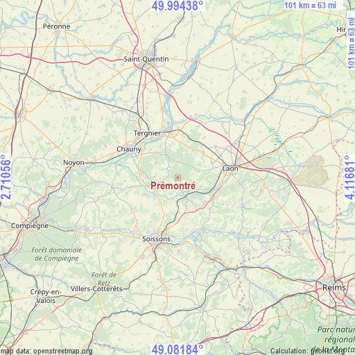
Prémontré GPS coordinates[2]
49° 32' 24.864" North, 3° 24' 49.248" East
| Map corner | latitude | longitude |
|---|---|---|
| Upper-left | 49.99438°, | 2.71056° |
| Center: | 49.54024°, | 3.41368° |
| Lower-right: | 49.08184°, | 4.11681° |
| Map W x H: | 101.5×101.5 km | = 63.1×63.1mi |
| max Lat: | 51.07786° ⇑10.1% North |
| Prémontré: | 49.54024° |
| min Lat: | ⇓89.9% South 41.3874° |
| min Long | Prémontré | max Long |
| -5.08615° | 3.41368° | 9.52242° |
| W 63.4%⇐ | ⇒36.6% E |
Elevation
Elevation of Prémontré is 110 m = 361 ft, and this is 83.7 m = 275 ft below average elevation for this country.
| Max E: |
2333 m = 7654 ft | 57.3% |
| Avg. | 193.7 m = 635 ft | |
| Prémontré | 110 m = 361 ft | |
Min E: |
-1 m = -3 ft | 42.7% |
See also: France elevation on elevation.city.
Geographical zone
Prémontré is located in North temperate zone (between Tropic of Cancer and the Arctic Circle). Distance of this North polar circle is 1892.8 km =1176.1 mi to North.| Distance of | km | miles | from Prémontré |
|---|---|---|---|
| North Pole | 4498.7 | 2795.4 | to North |
| Arctic Circle | 1892.8 | 1176.1 | to North |
| Tropic Cancer | 2902.4 | 1803.5 | to South |
| Equator | 5508.4 | 3422.8 | to South |


Nearby cities:
15 places around Prémontré: (largest is in red/bold)
• Amigny-Rouy
11.1 km =6.9 mi,  314°
314°
• Anizy-le-Château
4.6 km =2.9 mi,  143°
143°
• Autreville
13.4 km =8.3 mi,  291°
291°
• Barisis
7.5 km =4.7 mi, 309°
• Bertaucourt-Epourdon
8.8 km =5.5 mi,  345°
345°
• Brancourt-en-Laonnois
2.9 km =1.8 mi,  172°
172°
• Charmes
12.8 km =8 mi, 348°
• Chavignon
10.4 km =6.5 mi,  130°
130°
• Chivy-lès-Étouvelles
11.9 km =7.4 mi,  96°
96°
• Coucy-le-Château-Auffrique
6.8 km =4.2 mi,  251°
251°
• Crépy
10 km =6.2 mi,  48°
48°
• Folembray
8.8 km =5.5 mi,  272°
272°
• Pinon
6.2 km =3.9 mi,  157°
157°
• Saint-Gobain
6.7 km =4.2 mi,  337°
337°
• Urcel
11.7 km =7.3 mi,  117°
117°
Sources, notices
• [Note1] Compared only with cities in France existing in our database
• [Src1] Map data: © OpenStreetMap contributors (CC-BY-SA)
• [Src2] Other city data from geonames.org with taken over terms of usage.
• [Src3] Geographical zone / Annual Mean Temperature by Robert A. Rohde @ Wikipedia
