Anizy-le-Château geodata
Anizy-le-Château (Hauts-de-France) is a populated place; located in France in Europe/Paris (GMT+2) time zone. With population of 1,917 people, there are 4996 cities with bigger population in this country. Compared to other cities in France, 89.3% of cities are located further ↓South; 63.8% of cities are located further ←West and 71.4% of cities have higher elevation than Anizy-le-Château. Note1
Administrative division(s):
- Level 1: Hauts-de-France
- Level 2: Département de l'Aisne
- Level 3: Arrondissement de Laon
- Level 4: Anizy-le-Grand


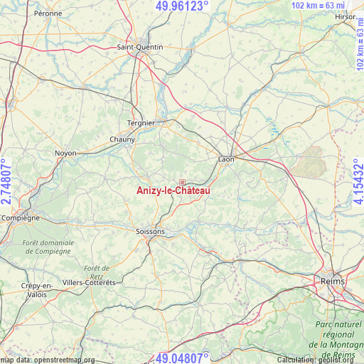
Anizy-le-Château GPS coordinates[2]
49° 30' 24.408" North, 3° 27' 4.284" East
| Map corner | latitude | longitude |
|---|---|---|
| Upper-left | 49.96123°, | 2.74807° |
| Center: | 49.50678°, | 3.45119° |
| Lower-right: | 49.04807°, | 4.15432° |
| Map W x H: | 101.5×101.5 km | = 63.1×63.1mi |
| max Lat: | 51.07786° ⇑10.7% North |
| Anizy-le-Château: | 49.50678° |
| min Lat: | ⇓89.3% South 41.3874° |
| min Long | Anizy-le-Châte | max Long |
| -5.08615° | 3.45119° | 9.52242° |
| W 63.8%⇐ | ⇒36.2% E |
Elevation
Elevation of Anizy-le-Château is 75 m = 246 ft, and this is 118.7 m = 389 ft below average elevation for this country.
| Max E: |
2333 m = 7654 ft | 71.4% |
| Avg. | 193.7 m = 635 ft | |
| Anizy-le-Château | 75 m = 246 ft | |
Min E: |
-1 m = -3 ft | 28.6% |
See also: France elevation on elevation.city.
Geographical zone
Anizy-le-Château is located in North temperate zone (between Tropic of Cancer and the Arctic Circle). Distance of this North polar circle is 1896.5 km =1178.4 mi to North.| Distance of | km | miles | from Anizy-le-Château |
|---|---|---|---|
| North Pole | 4502.4 | 2797.7 | to North |
| Arctic Circle | 1896.5 | 1178.4 | to North |
| Tropic Cancer | 2898.7 | 1801.2 | to South |
| Equator | 5504.6 | 3420.4 | to South |


Nearby cities:
15 places around Anizy-le-Château: (largest is in red/bold)
• Barisis
12 km =7.5 mi,  315°
315°
• Bertaucourt-Epourdon
13.2 km =8.2 mi,  338°
338°
• Brancourt-en-Laonnois
2.5 km =1.6 mi,  289°
289°
• Chavignon
6 km =3.7 mi,  120°
120°
• Chivres-Val
12.4 km =7.7 mi,  185°
185°
• Chivy-lès-Étouvelles
9.5 km =5.9 mi,  74°
74°
• Coucy-le-Château-Auffrique
9.3 km =5.8 mi,  279°
279°
• Crépy
11.4 km =7.1 mi,  24°
24°
• Folembray
12.2 km =7.6 mi, 289°
• Missy-sur-Aisne
13.4 km =8.3 mi,  184°
184°
• Pinon
2 km =1.2 mi, 188°
• Prémontré
4.6 km =2.9 mi, 323°
• Saint-Gobain
11.2 km =7 mi,  331°
331°
• Urcel
7.8 km =4.8 mi,  101°
101°
• Vailly-sur-Aisne
11.9 km =7.4 mi,  156°
156°
Sources, notices
• [Note1] Compared only with cities in France existing in our database
• [Src1] Map data: © OpenStreetMap contributors (CC-BY-SA)
• [Src2] Other city data from geonames.org with taken over terms of usage.
• [Src3] Geographical zone / Annual Mean Temperature by Robert A. Rohde @ Wikipedia
