Aillant-sur-Tholon geodata
Aillant-sur-Tholon (Bourgogne-Franche-Comté) is a populated place; located in France in Europe/Paris (GMT+2) time zone. With population of 1,530 people, there are 6080 cities with bigger population in this country. Compared to other cities in France, 57.1% of cities are located further ↓South; 62.6% of cities are located further ←West and 54.8% of cities have higher elevation than Aillant-sur-Tholon. Note1
Administrative division(s):
- Level 1: Bourgogne-Franche-Comté
- Level 2: Département de l'Yonne
- Level 3: Auxerre
- Level 4: Montholon


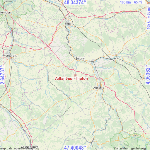
Aillant-sur-Tholon GPS coordinates[2]
47° 52' 27.336" North, 3° 21' 1.764" East
| Map corner | latitude | longitude |
|---|---|---|
| Upper-left | 48.34374°, | 2.64737° |
| Center: | 47.87426°, | 3.35049° |
| Lower-right: | 47.40048°, | 4.05362° |
| Map W x H: | 104.9×104.9 km | = 65.2×65.2mi |
| max Lat: | 51.07786° ⇑42.9% North |
| Aillant-sur-Tholon: | 47.87426° |
| min Lat: | ⇓57.1% South 41.3874° |
| min Long | Aillant-sur-Tho | max Long |
| -5.08615° | 3.35049° | 9.52242° |
| W 62.6%⇐ | ⇒37.4% E |
Elevation
Elevation of Aillant-sur-Tholon is 117 m = 384 ft, and this is 76.7 m = 252 ft below average elevation for this country.
| Max E: |
2333 m = 7654 ft | 54.8% |
| Avg. | 193.7 m = 635 ft | |
| Aillant-sur-Tholon | 117 m = 384 ft | |
Min E: |
-1 m = -3 ft | 45.2% |
See also: France elevation on elevation.city.
Geographical zone
Aillant-sur-Tholon is located in North temperate zone (between Tropic of Cancer and the Arctic Circle). Distance of this North polar circle is 2078.1 km =1291.3 mi to North.| Distance of | km | miles | from Aillant-sur-Tholon |
|---|---|---|---|
| North Pole | 4683.9 | 2910.4 | to North |
| Arctic Circle | 2078.1 | 1291.3 | to North |
| Tropic Cancer | 2717.2 | 1688.4 | to South |
| Equator | 5323.1 | 3307.6 | to South |


Nearby cities:
15 places around Aillant-sur-Tholon: (largest is in red/bold)
• Appoigny
13 km =8.1 mi,  89°
89°
• Champlay
10.8 km =6.7 mi,  37°
37°
• Champvallon
6.8 km =4.2 mi,  356°
356°
• Chamvres
9.2 km =5.7 mi,  5°
5°
• Charbuy
10.4 km =6.5 mi,  123°
123°
• Fleury-la-Vallée
7.4 km =4.6 mi,  96°
96°
• Guerchy
6.9 km =4.3 mi,  74°
74°
• Joigny
12.6 km =7.8 mi,  17°
17°
• La Celle-Saint-Cyr
11.9 km =7.4 mi,  337°
337°
• La Ferté-Loupière
9 km =5.6 mi,  286°
286°
• Lindry
9.6 km =6 mi,  148°
148°
• Parly
12.2 km =7.6 mi,  180°
180°
• Poilly-sur-Tholon
3.4 km =2.1 mi,  107°
107°
• Senan
4.3 km =2.7 mi, 8°
• Épineau-les-Voves
13 km =8.1 mi,  49°
49°
Sources, notices
• [Note1] Compared only with cities in France existing in our database
• [Src1] Map data: © OpenStreetMap contributors (CC-BY-SA)
• [Src2] Other city data from geonames.org with taken over terms of usage.
• [Src3] Geographical zone / Annual Mean Temperature by Robert A. Rohde @ Wikipedia
