Pont-Saint-Martin geodata
Pont-Saint-Martin (Pays de la Loire) is a populated place; located in France in Europe/Paris (GMT+2) time zone. With population of 5,114 people, there are 1925 cities with bigger population in this country. Compared to other cities in France, 54% of cities are located further ↑North; 92.9% of cities are located further →East and 98.2% of cities have higher elevation than Pont-Saint-Martin. Note1
Administrative division(s):
- Level 1: Pays de la Loire
- Level 2: Loire-Atlantique
- Level 3: Arrondissement de Nantes
- Level 4: Pont-Saint-Martin


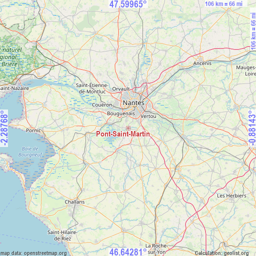
Pont-Saint-Martin GPS coordinates[2]
47° 7' 24.168" North, 1° 35' 4.38" West
| Map corner | latitude | longitude |
|---|---|---|
| Upper-left | 47.59965°, | -2.28768° |
| Center: | 47.12338°, | -1.58455° |
| Lower-right: | 46.64281°, | -0.88143° |
| Map W x H: | 106.4×106.4 km | = 66.1×66.1mi |
| max Lat: | 51.07786° ⇑54% North |
| Pont-Saint-Martin: | 47.12338° |
| min Lat: | ⇓46% South 41.3874° |
| min Long | Pont-Saint-Mart | max Long |
| -5.08615° | -1.58455° | 9.52242° |
| W 7.1%⇐ | ⇒92.9% E |
Elevation
Elevation of Pont-Saint-Martin is 8 m = 26 ft, and this is 185.7 m = 609 ft below average elevation for this country.
| Max E: |
2333 m = 7654 ft | 98.2% |
| Avg. | 193.7 m = 635 ft | |
| Pont-Saint-Martin | 8 m = 26 ft | |
Min E: |
-1 m = -3 ft | 1.8% |
See also: France elevation on elevation.city.
Geographical zone
Pont-Saint-Martin is located in North temperate zone (between Tropic of Cancer and the Arctic Circle). Distance of this North polar circle is 2161.5 km =1343.1 mi to North.| Distance of | km | miles | from Pont-Saint-Martin |
|---|---|---|---|
| North Pole | 4767.4 | 2962.3 | to North |
| Arctic Circle | 2161.5 | 1343.1 | to North |
| Tropic Cancer | 2633.7 | 1636.5 | to South |
| Equator | 5239.6 | 3255.7 | to South |


Nearby cities:
15 places around Pont-Saint-Martin: (largest is in red/bold)
• Bouaye
8.5 km =5.3 mi,  284°
284°
• Bouguenais
6.6 km =4.1 mi,  335°
335°
• Geneston
9.3 km =5.8 mi,  143°
143°
• Indre
10.5 km =6.5 mi,  323°
323°
• La Chevrolière
4 km =2.5 mi,  208°
208°
• La Montagne
10.2 km =6.3 mi,  313°
313°
• Le Bignon
7.6 km =4.7 mi,  112°
112°
• Les Sorinières
5 km =3.1 mi,  56°
56°
• Montbert
10.4 km =6.5 mi, 135°
• Nantes
10.7 km =6.6 mi,  12°
12°
• Rezé
7 km =4.3 mi,  22°
22°
• Saint-Léger-les-Vignes
11.1 km =6.9 mi, 277°
• Saint-Philbert-de-Grand-Lieu
10.6 km =6.6 mi,  203°
203°
• Saint-Sébastien-sur-Loire
11.2 km =7 mi,  33°
33°
• Vertou
10.1 km =6.3 mi, 59°
Sources, notices
• [Note1] Compared only with cities in France existing in our database
• [Src1] Map data: © OpenStreetMap contributors (CC-BY-SA)
• [Src2] Other city data from geonames.org with taken over terms of usage.
• [Src3] Geographical zone / Annual Mean Temperature by Robert A. Rohde @ Wikipedia
