Pommerit-le-Vicomte geodata
Pommerit-le-Vicomte (Brittany) is a populated place; located in France in Europe/Paris (GMT+2) time zone. With population of 1,810 people, there are 5233 cities with bigger population in this country. Compared to other cities in France, 71.3% of cities are located further ↓South; 97.5% of cities are located further →East and 59.7% of cities have higher elevation than Pommerit-le-Vicomte. Note1
Administrative division(s):
- Level 1: Brittany
- Level 2: Département des Côtes-d’Armor
- Level 3: Arrondissement de Guingamp
- Level 4: Pommerit-le-Vicomte


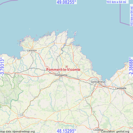
Pommerit-le-Vicomte GPS coordinates[2]
48° 37' 11.604" North, 3° 5' 24" West
| Map corner | latitude | longitude |
|---|---|---|
| Upper-left | 49.08255°, | -3.79313° |
| Center: | 48.61989°, | -3.09° |
| Lower-right: | 48.15295°, | -2.38688° |
| Map W x H: | 103.4×103.4 km | = 64.2×64.2mi |
| max Lat: | 51.07786° ⇑28.7% North |
| Pommerit-le-Vicomte: | 48.61989° |
| min Lat: | ⇓71.3% South 41.3874° |
| min Long | Pommerit-le-Vic | max Long |
| -5.08615° | -3.09° | 9.52242° |
| W 2.5%⇐ | ⇒97.5% E |
Elevation
Elevation of Pommerit-le-Vicomte is 103 m = 338 ft, and this is 90.7 m = 298 ft below average elevation for this country.
| Max E: |
2333 m = 7654 ft | 59.7% |
| Avg. | 193.7 m = 635 ft | |
| Pommerit-le-Vicomte | 103 m = 338 ft | |
Min E: |
-1 m = -3 ft | 40.3% |
See also: France elevation on elevation.city.
Geographical zone
Pommerit-le-Vicomte is located in North temperate zone (between Tropic of Cancer and the Arctic Circle). Distance of this North polar circle is 1995.1 km =1239.7 mi to North.| Distance of | km | miles | from Pommerit-le-Vicomte |
|---|---|---|---|
| North Pole | 4601 | 2858.9 | to North |
| Arctic Circle | 1995.1 | 1239.7 | to North |
| Tropic Cancer | 2800.1 | 1739.9 | to South |
| Equator | 5406 | 3359.1 | to South |


Nearby cities:
15 places around Pommerit-le-Vicomte: (largest is in red/bold)
• Goudelin
5.6 km =3.5 mi,  108°
108°
• Grâces
9.9 km =6.2 mi,  224°
224°
• Guingamp
7.8 km =4.8 mi, 215°
• Lanvollon
7.7 km =4.8 mi,  80°
80°
• Le Merzer
5.2 km =3.2 mi,  161°
161°
• Pabu
5.1 km =3.2 mi, 222°
• Plouisy
8.3 km =5.2 mi,  236°
236°
• Ploumagoar
8.9 km =5.5 mi,  200°
200°
• Pléhédel
10.4 km =6.5 mi,  35°
35°
• Pontrieux
10.4 km =6.5 mi,  330°
330°
• Quemper-Guézennec
9.4 km =5.8 mi,  353°
353°
• Saint-Agathon
6.9 km =4.3 mi,  189°
189°
• Saint-Clet
5.9 km =3.7 mi, 327°
• Squiffiec
4.8 km =3 mi,  281°
281°
• Tressignaux
7.7 km =4.8 mi,  92°
92°
Sources, notices
• [Note1] Compared only with cities in France existing in our database
• [Src1] Map data: © OpenStreetMap contributors (CC-BY-SA)
• [Src2] Other city data from geonames.org with taken over terms of usage.
• [Src3] Geographical zone / Annual Mean Temperature by Robert A. Rohde @ Wikipedia
