Goudelin geodata
Goudelin (Brittany) is a populated place; located in France in Europe/Paris (GMT+2) time zone. With population of 1,521 people, there are 6113 cities with bigger population in this country. Compared to other cities in France, 70.9% of cities are located further ↓South; 97.4% of cities are located further →East and 63.6% of cities have higher elevation than Goudelin. Note1
Administrative division(s):
- Level 1: Brittany
- Level 2: Département des Côtes-d’Armor
- Level 3: Arrondissement de Guingamp
- Level 4: Goudelin


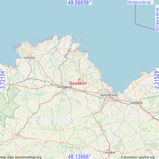
Goudelin GPS coordinates[2]
48° 36' 13.5" North, 3° 1' 6.312" West
| Map corner | latitude | longitude |
|---|---|---|
| Upper-left | 49.06656°, | -3.72154° |
| Center: | 48.60375°, | -3.01842° |
| Lower-right: | 48.13666°, | -2.31529° |
| Map W x H: | 103.4×103.4 km | = 64.2×64.2mi |
| max Lat: | 51.07786° ⇑29.1% North |
| Goudelin: | 48.60375° |
| min Lat: | ⇓70.9% South 41.3874° |
| min Long | Goudelin | max Long |
| -5.08615° | -3.01842° | 9.52242° |
| W 2.6%⇐ | ⇒97.4% E |
Elevation
Elevation of Goudelin is 93 m = 305 ft, and this is 100.7 m = 330 ft below average elevation for this country.
| Max E: |
2333 m = 7654 ft | 63.6% |
| Avg. | 193.7 m = 635 ft | |
| Goudelin | 93 m = 305 ft | |
Min E: |
-1 m = -3 ft | 36.4% |
See also: France elevation on elevation.city.
Geographical zone
Goudelin is located in North temperate zone (between Tropic of Cancer and the Arctic Circle). Distance of this North polar circle is 1996.9 km =1240.8 mi to North.| Distance of | km | miles | from Goudelin |
|---|---|---|---|
| North Pole | 4602.8 | 2860 | to North |
| Arctic Circle | 1996.9 | 1240.8 | to North |
| Tropic Cancer | 2798.3 | 1738.8 | to South |
| Equator | 5404.2 | 3358 | to South |


Nearby cities:
15 places around Goudelin: (largest is in red/bold)
• Châtelaudren
7.9 km =4.9 mi,  154°
154°
• Lanrodec
9.8 km =6.1 mi,  185°
185°
• Lantic
10 km =6.2 mi,  88°
88°
• Lanvollon
3.9 km =2.4 mi,  37°
37°
• Le Merzer
4.8 km =3 mi,  229°
229°
• Pabu
8.9 km =5.5 mi,  257°
257°
• Plouagat
7.6 km =4.7 mi,  169°
169°
• Pléguien
6.7 km =4.2 mi,  58°
58°
• Pléhédel
10.3 km =6.4 mi,  4°
4°
• Plélo
7.6 km =4.7 mi,  135°
135°
• Pommerit-le-Vicomte
5.6 km =3.5 mi,  288°
288°
• Saint-Agathon
8.1 km =5 mi, 231°
• Squiffiec
10.3 km =6.4 mi, 285°
• Tressignaux
2.8 km =1.7 mi, 59°
• Tréguidel
5.6 km =3.5 mi, 92°
Sources, notices
• [Note1] Compared only with cities in France existing in our database
• [Src1] Map data: © OpenStreetMap contributors (CC-BY-SA)
• [Src2] Other city data from geonames.org with taken over terms of usage.
• [Src3] Geographical zone / Annual Mean Temperature by Robert A. Rohde @ Wikipedia
