Blain geodata
Blain (Pays de la Loire) is a populated place; located in France in Europe/Paris (GMT+2) time zone. With population of 8,274 people, there are 1173 cities with bigger population in this country. Compared to other cities in France, 50.9% of cities are located further ↓South; 93.9% of cities are located further →East and 91.2% of cities have higher elevation than Blain. Note1
Administrative division(s):
- Level 1: Pays de la Loire
- Level 2: Loire-Atlantique
- Level 3: Arrondissement of Châteaubriant-Ancenis
- Level 4: Blain


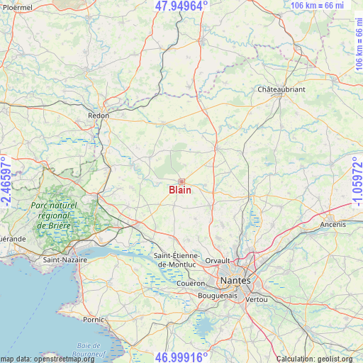
Blain GPS coordinates[2]
47° 28' 35.58" North, 1° 45' 46.26" West
| Map corner | latitude | longitude |
|---|---|---|
| Upper-left | 47.94964°, | -2.46597° |
| Center: | 47.47655°, | -1.76285° |
| Lower-right: | 46.99916°, | -1.05972° |
| Map W x H: | 105.7×105.7 km | = 65.7×65.7mi |
| max Lat: | 51.07786° ⇑49.1% North |
| Blain: | 47.47655° |
| min Lat: | ⇓50.9% South 41.3874° |
| min Long | Blain | max Long |
| -5.08615° | -1.76285° | 9.52242° |
| W 6.1%⇐ | ⇒93.9% E |
Elevation
Elevation of Blain is 27 m = 89 ft, and this is 166.7 m = 547 ft below average elevation for this country.
| Max E: |
2333 m = 7654 ft | 91.2% |
| Avg. | 193.7 m = 635 ft | |
| Blain | 27 m = 89 ft | |
Min E: |
-1 m = -3 ft | 8.8% |
See also: France elevation on elevation.city.
Geographical zone
Blain is located in North temperate zone (between Tropic of Cancer and the Arctic Circle). Distance of this North polar circle is 2122.3 km =1318.7 mi to North.| Distance of | km | miles | from Blain |
|---|---|---|---|
| North Pole | 4728.2 | 2938 | to North |
| Arctic Circle | 2122.3 | 1318.7 | to North |
| Tropic Cancer | 2673 | 1660.9 | to South |
| Equator | 5278.9 | 3280.2 | to South |


Nearby cities:
15 places around Blain: (largest is in red/bold)
• Bouvron
9.1 km =5.7 mi,  223°
223°
• Fay-de-Bretagne
7.2 km =4.5 mi,  197°
197°
• Héric
10.8 km =6.7 mi,  130°
130°
• La Chevallerais
7 km =4.3 mi,  97°
97°
• La Grigonnais
9.1 km =5.7 mi,  51°
51°
• Le Gâvre
5.1 km =3.2 mi,  11°
11°
• Malville
15.1 km =9.4 mi,  209°
209°
• Marsac-sur-Don
14.7 km =9.1 mi,  25°
25°
• Notre-Dame-des-Landes
11.4 km =7.1 mi,  159°
159°
• Nozay
14.2 km =8.8 mi, 46°
• Plessé
11.8 km =7.3 mi,  308°
308°
• Puceul
12.1 km =7.5 mi,  65°
65°
• Quilly
14.4 km =8.9 mi,  263°
263°
• Saffré
14.1 km =8.8 mi,  78°
78°
• Vay
9.9 km =6.2 mi, 28°
Sources, notices
• [Note1] Compared only with cities in France existing in our database
• [Src1] Map data: © OpenStreetMap contributors (CC-BY-SA)
• [Src2] Other city data from geonames.org with taken over terms of usage.
• [Src3] Geographical zone / Annual Mean Temperature by Robert A. Rohde @ Wikipedia
