Pléguien geodata
Pléguien (Brittany) is a populated place; located in France in Europe/Paris (GMT+2) time zone. With population of 1,049 people, there are 8470 cities with bigger population in this country. Compared to other cities in France, 71.7% of cities are located further ↓South; 97.2% of cities are located further →East and 71.9% of cities have higher elevation than Pléguien. Note1
Administrative division(s):
- Level 1: Brittany
- Level 2: Département des Côtes-d’Armor
- Level 3: Arrondissement de Guingamp
- Level 4: Pléguien


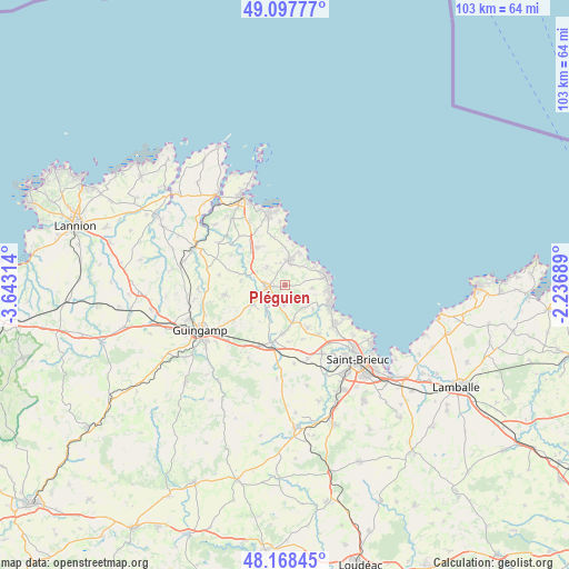
Pléguien GPS coordinates[2]
48° 38' 6.9" North, 2° 56' 24.036" West
| Map corner | latitude | longitude |
|---|---|---|
| Upper-left | 49.09777°, | -3.64314° |
| Center: | 48.63525°, | -2.94001° |
| Lower-right: | 48.16845°, | -2.23689° |
| Map W x H: | 103.3×103.3 km | = 64.2×64.2mi |
| max Lat: | 51.07786° ⇑28.3% North |
| Pléguien: | 48.63525° |
| min Lat: | ⇓71.7% South 41.3874° |
| min Long | Pléguien | max Long |
| -5.08615° | -2.94001° | 9.52242° |
| W 2.8%⇐ | ⇒97.2% E |
Elevation
Elevation of Pléguien is 74 m = 243 ft, and this is 119.7 m = 393 ft below average elevation for this country.
| Max E: |
2333 m = 7654 ft | 71.9% |
| Avg. | 193.7 m = 635 ft | |
| Pléguien | 74 m = 243 ft | |
Min E: |
-1 m = -3 ft | 28.1% |
See also: France elevation on elevation.city.
Geographical zone
Pléguien is located in North temperate zone (between Tropic of Cancer and the Arctic Circle). Distance of this North polar circle is 1993.4 km =1238.6 mi to North.| Distance of | km | miles | from Pléguien |
|---|---|---|---|
| North Pole | 4599.3 | 2857.9 | to North |
| Arctic Circle | 1993.4 | 1238.6 | to North |
| Tropic Cancer | 2801.8 | 1741 | to South |
| Equator | 5407.7 | 3360.2 | to South |


Nearby cities:
15 places around Pléguien: (largest is in red/bold)
• Binic
9.2 km =5.7 mi,  114°
114°
• Châtelaudren
10.9 km =6.8 mi,  192°
192°
• Goudelin
6.7 km =4.2 mi,  238°
238°
• Lantic
5.3 km =3.3 mi,  126°
126°
• Lanvollon
3.4 km =2.1 mi,  262°
262°
• Plouha
4.7 km =2.9 mi,  10°
10°
• Pléhédel
8.5 km =5.3 mi,  323°
323°
• Plélo
8.9 km =5.5 mi,  182°
182°
• Pommerit-le-Vicomte
11.2 km =7 mi, 261°
• Saint-Quay-Portrieux
8.2 km =5.1 mi,  78°
78°
• Tressignaux
3.9 km =2.4 mi, 238°
• Trégomeur
8.7 km =5.4 mi,  151°
151°
• Tréguidel
3.8 km =2.4 mi, 183°
• Tréveneuc
6.2 km =3.9 mi,  57°
57°
• Étables-sur-Mer
7.8 km =4.8 mi,  91°
91°
Sources, notices
• [Note1] Compared only with cities in France existing in our database
• [Src1] Map data: © OpenStreetMap contributors (CC-BY-SA)
• [Src2] Other city data from geonames.org with taken over terms of usage.
• [Src3] Geographical zone / Annual Mean Temperature by Robert A. Rohde @ Wikipedia
