Pleaux geodata
Pleaux (Auvergne-Rhône-Alpes) is a populated place; located in France in Europe/Paris (GMT+2) time zone. With population of 1,838 people, there are 5157 cities with bigger population in this country. Compared to other cities in France, 78.1% of cities are located further ↑North; 54% of cities are located further →East and 95.7% of cities have lower elevation than Pleaux. Note1
Administrative division(s):
- Level 1: Auvergne-Rhône-Alpes
- Level 2: Cantal
- Level 3: Arrondissement de Mauriac
- Level 4: Pleaux


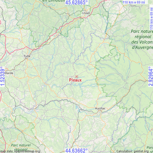
Pleaux GPS coordinates[2]
45° 8' 5.244" North, 2° 13' 35.472" East
| Map corner | latitude | longitude |
|---|---|---|
| Upper-left | 45.62865°, | 1.52339° |
| Center: | 45.13479°, | 2.22652° |
| Lower-right: | 44.63662°, | 2.92964° |
| Map W x H: | 110.3×110.3 km | = 68.5×68.5mi |
| max Lat: | 51.07786° ⇑78.1% North |
| Pleaux: | 45.13479° |
| min Lat: | ⇓21.9% South 41.3874° |
| min Long | Pleaux | max Long |
| -5.08615° | 2.22652° | 9.52242° |
| W 46%⇐ | ⇒54% E |
Elevation
Elevation of Pleaux is 626 m = 2054 ft, and this is 432.3 m = 1418 ft above average elevation for this country.
| Max E: |
2333 m = 7654 ft | 4.3% |
| Pleaux | 626 m 2054 ft | |
| Avg. | 193.7 m = 635 ft | |
Min E: |
-1 m = -3 ft | 95.7% |
See also: France elevation on elevation.city.
Geographical zone
Pleaux is located in North temperate zone (between Tropic of Cancer and the Arctic Circle). Distance of this North polar circle is 2382.7 km =1480.5 mi to North.| Distance of | km | miles | from Pleaux |
|---|---|---|---|
| North Pole | 4988.5 | 3099.7 | to North |
| Arctic Circle | 2382.7 | 1480.5 | to North |
| Tropic Cancer | 2412.6 | 1499.1 | to South |
| Equator | 5018.5 | 3118.4 | to South |


Nearby cities:
15 places around Pleaux: (largest is in red/bold)
• Anglards-de-Salers
18.4 km =11.4 mi,  65°
65°
• Ayrens
18.5 km =11.5 mi,  154°
154°
• Laroquebrou
18.7 km =11.6 mi,  188°
188°
• Le Vigean
14.3 km =8.9 mi,  44°
44°
• Marcillac-la-Croisille
21.7 km =13.5 mi,  314°
314°
• Mauriac
12.6 km =7.8 mi, 41°
• Saint-Cernin
17.5 km =10.9 mi,  119°
119°
• Saint-Illide
10.7 km =6.6 mi,  139°
139°
• Saint-Julien-aux-Bois
6.9 km =4.3 mi,  265°
265°
• Saint-Martin-Valmeroux
15.7 km =9.8 mi,  97°
97°
• Saint-Paul-des-Landes
22.4 km =13.9 mi,  162°
162°
• Saint-Privat
10 km =6.2 mi, 272°
• Servières-le-Château
15.8 km =9.8 mi, 268°
• Siran
21.5 km =13.4 mi,  201°
201°
• Soursac
15.8 km =9.8 mi,  352°
352°
Sources, notices
• [Note1] Compared only with cities in France existing in our database
• [Src1] Map data: © OpenStreetMap contributors (CC-BY-SA)
• [Src2] Other city data from geonames.org with taken over terms of usage.
• [Src3] Geographical zone / Annual Mean Temperature by Robert A. Rohde @ Wikipedia
