Soursac geodata
Soursac (Nouvelle-Aquitaine) is a populated place; located in France in Europe/Paris (GMT+2) time zone. With population of 533 people, there are 14546 cities with bigger population in this country. Compared to other cities in France, 76.6% of cities are located further ↑North; 54.4% of cities are located further →East and 93.5% of cities have lower elevation than Soursac. Note1
Administrative division(s):
- Level 1: Nouvelle-Aquitaine
- Level 2: Département de la Corrèze
- Level 3: Ussel
- Level 4: Soursac


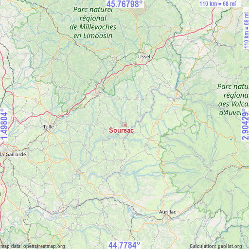
Soursac GPS coordinates[2]
45° 16' 31.26" North, 2° 12' 4.212" East
| Map corner | latitude | longitude |
|---|---|---|
| Upper-left | 45.76798°, | 1.49804° |
| Center: | 45.27535°, | 2.20117° |
| Lower-right: | 44.7784°, | 2.90429° |
| Map W x H: | 110×110 km | = 68.4×68.4mi |
| max Lat: | 51.07786° ⇑76.6% North |
| Soursac: | 45.27535° |
| min Lat: | ⇓23.4% South 41.3874° |
| min Long | Soursac | max Long |
| -5.08615° | 2.20117° | 9.52242° |
| W 45.6%⇐ | ⇒54.4% E |
Elevation
Elevation of Soursac is 521 m = 1709 ft, and this is 327.3 m = 1074 ft above average elevation for this country.
| Max E: |
2333 m = 7654 ft | 6.5% |
| Soursac | 521 m 1709 ft | |
| Avg. | 193.7 m = 635 ft | |
Min E: |
-1 m = -3 ft | 93.5% |
See also: France elevation on elevation.city.
Geographical zone
Soursac is located in North temperate zone (between Tropic of Cancer and the Arctic Circle). Distance of this North polar circle is 2367 km =1470.8 mi to North.| Distance of | km | miles | from Soursac |
|---|---|---|---|
| North Pole | 4972.9 | 3090 | to North |
| Arctic Circle | 2367 | 1470.8 | to North |
| Tropic Cancer | 2428.2 | 1508.8 | to South |
| Equator | 5034.1 | 3128 | to South |


Nearby cities:
15 places around Soursac: (largest is in red/bold)
• Anglards-de-Salers
20.3 km =12.6 mi,  112°
112°
• Champagnac
17.9 km =11.1 mi,  59°
59°
• Eyrein
21.2 km =13.2 mi,  288°
288°
• Le Vigean
13.1 km =8.1 mi, 114°
• Marcillac-la-Croisille
13.4 km =8.3 mi,  268°
268°
• Mauriac
12.1 km =7.5 mi,  121°
121°
• Neuvic
13 km =8.1 mi,  24°
24°
• Pleaux
15.8 km =9.8 mi,  172°
172°
• Saignes
22.7 km =14.1 mi,  73°
73°
• Saint-Hippolyte
17.3 km =10.7 mi,  300°
300°
• Saint-Julien-aux-Bois
16.9 km =10.5 mi,  196°
196°
• Saint-Privat
17.2 km =10.7 mi,  207°
207°
• Servières-le-Château
21.2 km =13.2 mi,  220°
220°
• Ydes
20.1 km =12.5 mi, 66°
• Égletons
19 km =11.8 mi,  320°
320°
Sources, notices
• [Note1] Compared only with cities in France existing in our database
• [Src1] Map data: © OpenStreetMap contributors (CC-BY-SA)
• [Src2] Other city data from geonames.org with taken over terms of usage.
• [Src3] Geographical zone / Annual Mean Temperature by Robert A. Rohde @ Wikipedia
