Mauriac geodata
Mauriac (Auvergne-Rhône-Alpes) is a seat of a third-order administrative division; located in France in Europe/Paris (GMT+2) time zone. With population of 3,955 people, there are 2490 cities with bigger population in this country. Compared to other cities in France, 77.2% of cities are located further ↑North; 52.1% of cities are located further →East and 97.1% of cities have lower elevation than Mauriac. Note1
Administrative division(s):
- Level 1: Auvergne-Rhône-Alpes
- Level 2: Cantal
- Level 3: Arrondissement de Mauriac
- Level 4: Mauriac


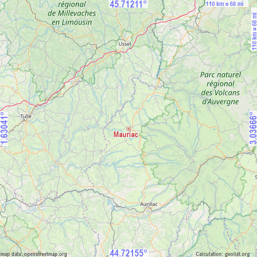
Mauriac GPS coordinates[2]
45° 13' 8.364" North, 2° 20' 0.708" East
| Map corner | latitude | longitude |
|---|---|---|
| Upper-left | 45.71211°, | 1.63041° |
| Center: | 45.21899°, | 2.33353° |
| Lower-right: | 44.72155°, | 3.03666° |
| Map W x H: | 110.1×110.1 km | = 68.4×68.4mi |
| max Lat: | 51.07786° ⇑77.2% North |
| Mauriac: | 45.21899° |
| min Lat: | ⇓22.8% South 41.3874° |
| min Long | Mauriac | max Long |
| -5.08615° | 2.33353° | 9.52242° |
| W 47.9%⇐ | ⇒52.1% E |
Elevation
Elevation of Mauriac is 732 m = 2402 ft, and this is 538.3 m = 1766 ft above average elevation for this country.
| Max E: |
2333 m = 7654 ft | 2.9% |
| Mauriac | 732 m 2402 ft | |
| Avg. | 193.7 m = 635 ft | |
Min E: |
-1 m = -3 ft | 97.1% |
See also: France elevation on elevation.city.
Geographical zone
Mauriac is located in North temperate zone (between Tropic of Cancer and the Arctic Circle). Distance of this North polar circle is 2373.3 km =1474.7 mi to North.| Distance of | km | miles | from Mauriac |
|---|---|---|---|
| North Pole | 4979.2 | 3093.9 | to North |
| Arctic Circle | 2373.3 | 1474.7 | to North |
| Tropic Cancer | 2422 | 1505 | to South |
| Equator | 5027.9 | 3124.2 | to South |


Nearby cities:
15 places around Mauriac: (largest is in red/bold)
• Anglards-de-Salers
8.5 km =5.3 mi,  100°
100°
• Champagnac
16.1 km =10 mi,  18°
18°
• Le Vigean
1.8 km =1.1 mi,  60°
60°
• Menet
21.4 km =13.3 mi,  66°
66°
• Neuvic
18.7 km =11.6 mi,  344°
344°
• Pleaux
12.6 km =7.8 mi,  221°
221°
• Saignes
17.2 km =10.7 mi,  41°
41°
• Saint-Cernin
19.1 km =11.9 mi,  159°
159°
• Saint-Illide
17.6 km =10.9 mi,  184°
184°
• Saint-Julien-aux-Bois
18.2 km =11.3 mi,  236°
236°
• Saint-Martin-Valmeroux
13.4 km =8.3 mi,  147°
147°
• Saint-Privat
20.5 km =12.7 mi, 243°
• Soursac
12.1 km =7.5 mi,  301°
301°
• Trizac
16.5 km =10.3 mi,  76°
76°
• Ydes
16.4 km =10.2 mi,  29°
29°
Sources, notices
• [Note1] Compared only with cities in France existing in our database
• [Src1] Map data: © OpenStreetMap contributors (CC-BY-SA)
• [Src2] Other city data from geonames.org with taken over terms of usage.
• [Src3] Geographical zone / Annual Mean Temperature by Robert A. Rohde @ Wikipedia
