Le Vigean geodata
Le Vigean (Auvergne-Rhône-Alpes) is a populated place; located in France in Europe/Paris (GMT+2) time zone. With population of 893 people, there are 9714 cities with bigger population in this country. Compared to other cities in France, 77.1% of cities are located further ↑North; 51.8% of cities are located further →East and 96.9% of cities have lower elevation than Le Vigean. Note1
Administrative division(s):
- Level 1: Auvergne-Rhône-Alpes
- Level 2: Cantal
- Level 3: Arrondissement de Mauriac
- Level 4: Le Vigean


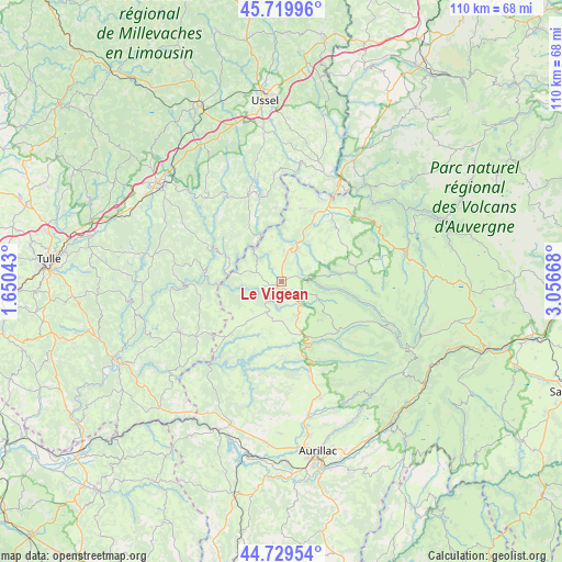
Le Vigean GPS coordinates[2]
45° 13' 36.876" North, 2° 21' 12.816" East
| Map corner | latitude | longitude |
|---|---|---|
| Upper-left | 45.71996°, | 1.65043° |
| Center: | 45.22691°, | 2.35356° |
| Lower-right: | 44.72954°, | 3.05668° |
| Map W x H: | 110.1×110.1 km | = 68.4×68.4mi |
| max Lat: | 51.07786° ⇑77.1% North |
| Le Vigean: | 45.22691° |
| min Lat: | ⇓22.9% South 41.3874° |
| min Long | Le Vigean | max Long |
| -5.08615° | 2.35356° | 9.52242° |
| W 48.2%⇐ | ⇒51.8% E |
Elevation
Elevation of Le Vigean is 720 m = 2362 ft, and this is 526.3 m = 1727 ft above average elevation for this country.
| Max E: |
2333 m = 7654 ft | 3.1% |
| Le Vigean | 720 m 2362 ft | |
| Avg. | 193.7 m = 635 ft | |
Min E: |
-1 m = -3 ft | 96.9% |
See also: France elevation on elevation.city.
Geographical zone
Le Vigean is located in North temperate zone (between Tropic of Cancer and the Arctic Circle). Distance of this North polar circle is 2372.4 km =1474.1 mi to North.| Distance of | km | miles | from Le Vigean |
|---|---|---|---|
| North Pole | 4978.3 | 3093.4 | to North |
| Arctic Circle | 2372.4 | 1474.1 | to North |
| Tropic Cancer | 2422.8 | 1505.5 | to South |
| Equator | 5028.8 | 3124.8 | to South |


Nearby cities:
15 places around Le Vigean: (largest is in red/bold)
• Anglards-de-Salers
7.2 km =4.5 mi,  110°
110°
• Bort-les-Orgues
22.2 km =13.8 mi,  30°
30°
• Champagnac
14.9 km =9.3 mi,  13°
13°
• Mauriac
1.8 km =1.1 mi,  240°
240°
• Menet
19.6 km =12.2 mi,  66°
66°
• Neuvic
18.3 km =11.4 mi,  339°
339°
• Pleaux
14.3 km =8.9 mi,  224°
224°
• Saignes
15.5 km =9.6 mi,  39°
39°
• Saint-Cernin
19.5 km =12.1 mi,  164°
164°
• Saint-Illide
18.6 km =11.6 mi,  189°
189°
• Saint-Julien-aux-Bois
20 km =12.4 mi, 237°
• Saint-Martin-Valmeroux
13.4 km =8.3 mi, 155°
• Soursac
13.1 km =8.1 mi,  294°
294°
• Trizac
14.8 km =9.2 mi,  78°
78°
• Ydes
14.9 km =9.3 mi, 26°
Sources, notices
• [Note1] Compared only with cities in France existing in our database
• [Src1] Map data: © OpenStreetMap contributors (CC-BY-SA)
• [Src2] Other city data from geonames.org with taken over terms of usage.
• [Src3] Geographical zone / Annual Mean Temperature by Robert A. Rohde @ Wikipedia
