Peltre geodata
Peltre (Grand Est) is a populated place; located in France in Europe/Paris (GMT+2) time zone. With population of 1,654 people, there are 5653 cities with bigger population in this country. Compared to other cities in France, 81.5% of cities are located further ↓South; 89.6% of cities are located further ←West and 65.6% of cities have lower elevation than Peltre. Note1
Administrative division(s):
- Level 1: Grand Est
- Level 2: Moselle
- Level 3: Arrondissement de Metz
- Level 4: Peltre


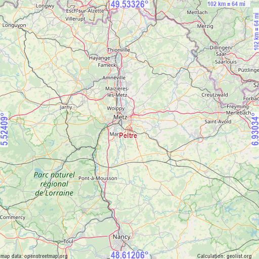
Peltre GPS coordinates[2]
49° 4' 29.28" North, 6° 13' 37.956" East
| Map corner | latitude | longitude |
|---|---|---|
| Upper-left | 49.53326°, | 5.52409° |
| Center: | 49.0748°, | 6.22721° |
| Lower-right: | 48.61206°, | 6.93034° |
| Map W x H: | 102.4×102.4 km | = 63.6×63.6mi |
| max Lat: | 51.07786° ⇑18.5% North |
| Peltre: | 49.0748° |
| min Lat: | ⇓81.5% South 41.3874° |
| min Long | Peltre | max Long |
| -5.08615° | 6.22721° | 9.52242° |
| W 89.6%⇐ | ⇒10.4% E |
Elevation
Elevation of Peltre is 197 m = 646 ft, and this is 3.3 m = 11 ft above average elevation for this country.
| Max E: |
2333 m = 7654 ft | 34.4% |
| Peltre | 197 m 646 ft | |
| Avg. | 193.7 m = 635 ft | |
Min E: |
-1 m = -3 ft | 65.6% |
See also: France elevation on elevation.city.
Geographical zone
Peltre is located in North temperate zone (between Tropic of Cancer and the Arctic Circle). Distance of this North polar circle is 1944.6 km =1208.3 mi to North.| Distance of | km | miles | from Peltre |
|---|---|---|---|
| North Pole | 4550.5 | 2827.5 | to North |
| Arctic Circle | 1944.6 | 1208.3 | to North |
| Tropic Cancer | 2850.7 | 1771.3 | to South |
| Equator | 5456.6 | 3390.6 | to South |


Nearby cities:
15 places around Peltre: (largest is in red/bold)
• Ars-Laquenexy
3.8 km =2.4 mi,  55°
55°
• Coin-lès-Cuvry
6.9 km =4.3 mi,  228°
228°
• Courcelles-sur-Nied
6 km =3.7 mi,  98°
98°
• Cuvry
6.1 km =3.8 mi, 234°
• Fleury
4.4 km =2.7 mi,  213°
213°
• Jury
1.9 km =1.2 mi,  107°
107°
• Laquenexy
6.4 km =4 mi,  86°
86°
• Marly
5.5 km =3.4 mi,  257°
257°
• Metz
6.3 km =3.9 mi,  321°
321°
• Montigny-lès-Metz
5.9 km =3.7 mi,  293°
293°
• Mécleuves
4.6 km =2.9 mi,  137°
137°
• Noisseville
7.4 km =4.6 mi,  27°
27°
• Pouilly
4.1 km =2.5 mi, 227°
• Saint-Julien-lès-Metz
6.7 km =4.2 mi,  344°
344°
• Vantoux
6.1 km =3.8 mi,  3°
3°
Sources, notices
• [Note1] Compared only with cities in France existing in our database
• [Src1] Map data: © OpenStreetMap contributors (CC-BY-SA)
• [Src2] Other city data from geonames.org with taken over terms of usage.
• [Src3] Geographical zone / Annual Mean Temperature by Robert A. Rohde @ Wikipedia
