Noisseville geodata
Noisseville (Grand Est) is a populated place; located in France in Europe/Paris (GMT+2) time zone. With population of 962 people, there are 9112 cities with bigger population in this country. Compared to other cities in France, 83% of cities are located further ↓South; 89.9% of cities are located further ←West and 73% of cities have lower elevation than Noisseville. Note1
Administrative division(s):
- Level 1: Grand Est
- Level 2: Moselle
- Level 3: Arrondissement de Metz
- Level 4: Noisseville


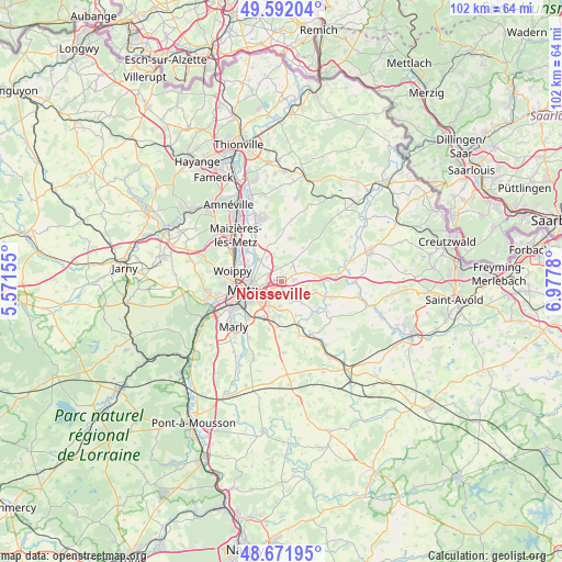
Noisseville GPS coordinates[2]
49° 8' 2.868" North, 6° 16' 28.848" East
| Map corner | latitude | longitude |
|---|---|---|
| Upper-left | 49.59204°, | 5.57155° |
| Center: | 49.13413°, | 6.27468° |
| Lower-right: | 48.67195°, | 6.9778° |
| Map W x H: | 102.3×102.3 km | = 63.6×63.6mi |
| max Lat: | 51.07786° ⇑17% North |
| Noisseville: | 49.13413° |
| min Lat: | ⇓83% South 41.3874° |
| min Long | Noisseville | max Long |
| -5.08615° | 6.27468° | 9.52242° |
| W 89.9%⇐ | ⇒10.1% E |
Elevation
Elevation of Noisseville is 236 m = 774 ft, and this is 42.3 m = 139 ft above average elevation for this country.
| Max E: |
2333 m = 7654 ft | 27% |
| Noisseville | 236 m 774 ft | |
| Avg. | 193.7 m = 635 ft | |
Min E: |
-1 m = -3 ft | 73% |
See also: France elevation on elevation.city.
Geographical zone
Noisseville is located in North temperate zone (between Tropic of Cancer and the Arctic Circle). Distance of this North polar circle is 1938 km =1204.2 mi to North.| Distance of | km | miles | from Noisseville |
|---|---|---|---|
| North Pole | 4543.9 | 2823.4 | to North |
| Arctic Circle | 1938 | 1204.2 | to North |
| Tropic Cancer | 2857.3 | 1775.4 | to South |
| Equator | 5463.2 | 3394.7 | to South |


Nearby cities:
15 places around Noisseville: (largest is in red/bold)
• Ars-Laquenexy
4.5 km =2.8 mi,  184°
184°
• Charly-Oradour
5.2 km =3.2 mi,  329°
329°
• Failly
2.8 km =1.7 mi,  339°
339°
• Jury
7.3 km =4.5 mi,  192°
192°
• La Maxe
7.2 km =4.5 mi,  301°
301°
• Laquenexy
6.8 km =4.2 mi,  155°
155°
• Metz
7.6 km =4.7 mi,  257°
257°
• Pange
7.9 km =4.9 mi,  133°
133°
• Peltre
7.4 km =4.6 mi,  207°
207°
• Retonfey
2.3 km =1.4 mi,  83°
83°
• Saint-Julien-lès-Metz
5.3 km =3.3 mi,  268°
268°
• Sainte-Barbe
3.4 km =2.1 mi,  34°
34°
• Sanry-lès-Vigy
5.4 km =3.4 mi,  3°
3°
• Silly-sur-Nied
6.3 km =3.9 mi,  104°
104°
• Vantoux
3.1 km =1.9 mi, 260°
Sources, notices
• [Note1] Compared only with cities in France existing in our database
• [Src1] Map data: © OpenStreetMap contributors (CC-BY-SA)
• [Src2] Other city data from geonames.org with taken over terms of usage.
• [Src3] Geographical zone / Annual Mean Temperature by Robert A. Rohde @ Wikipedia
