Ars-Laquenexy geodata
Ars-Laquenexy (Grand Est) is a populated place; located in France in Europe/Paris (GMT+2) time zone. With population of 773 people, there are 10903 cities with bigger population in this country. Compared to other cities in France, 82% of cities are located further ↓South; 89.9% of cities are located further ←West and 72.8% of cities have lower elevation than Ars-Laquenexy. Note1
Administrative division(s):
- Level 1: Grand Est
- Level 2: Moselle
- Level 3: Arrondissement de Metz
- Level 4: Ars-Laquenexy


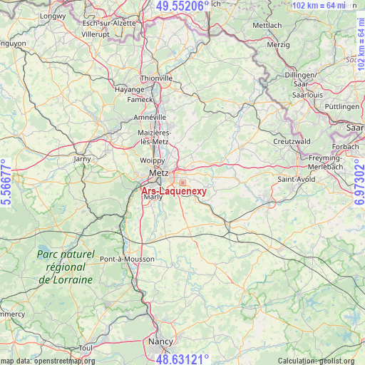
Ars-Laquenexy GPS coordinates[2]
49° 5' 37.572" North, 6° 16' 11.604" East
| Map corner | latitude | longitude |
|---|---|---|
| Upper-left | 49.55206°, | 5.56677° |
| Center: | 49.09377°, | 6.26989° |
| Lower-right: | 48.63121°, | 6.97302° |
| Map W x H: | 102.4×102.4 km | = 63.6×63.6mi |
| max Lat: | 51.07786° ⇑18% North |
| Ars-Laquenexy: | 49.09377° |
| min Lat: | ⇓82% South 41.3874° |
| min Long | Ars-Laquenexy | max Long |
| -5.08615° | 6.26989° | 9.52242° |
| W 89.9%⇐ | ⇒10.1% E |
Elevation
Elevation of Ars-Laquenexy is 235 m = 771 ft, and this is 41.3 m = 135 ft above average elevation for this country.
| Max E: |
2333 m = 7654 ft | 27.2% |
| Ars-Laquenexy | 235 m 771 ft | |
| Avg. | 193.7 m = 635 ft | |
Min E: |
-1 m = -3 ft | 72.8% |
See also: France elevation on elevation.city.
Geographical zone
Ars-Laquenexy is located in North temperate zone (between Tropic of Cancer and the Arctic Circle). Distance of this North polar circle is 1942.5 km =1207 mi to North.| Distance of | km | miles | from Ars-Laquenexy |
|---|---|---|---|
| North Pole | 4548.3 | 2826.2 | to North |
| Arctic Circle | 1942.5 | 1207 | to North |
| Tropic Cancer | 2852.8 | 1772.6 | to South |
| Equator | 5458.7 | 3391.9 | to South |


Nearby cities:
15 places around Ars-Laquenexy: (largest is in red/bold)
• Courcelles-sur-Nied
4.1 km =2.5 mi,  137°
137°
• Failly
7.1 km =4.4 mi,  355°
355°
• Jury
3 km =1.9 mi,  205°
205°
• Laquenexy
3.7 km =2.3 mi,  117°
117°
• Metz
7.6 km =4.7 mi,  291°
291°
• Mécleuves
5.5 km =3.4 mi,  179°
179°
• Noisseville
4.5 km =2.8 mi,  4°
4°
• Pange
6.2 km =3.9 mi,  98°
98°
• Peltre
3.8 km =2.4 mi,  235°
235°
• Pouilly
7.8 km =4.8 mi,  231°
231°
• Retonfey
5.4 km =3.4 mi,  29°
29°
• Saint-Julien-lès-Metz
6.6 km =4.1 mi,  311°
311°
• Sainte-Barbe
7.6 km =4.7 mi,  17°
17°
• Silly-sur-Nied
7.1 km =4.4 mi,  65°
65°
• Vantoux
4.8 km =3 mi,  325°
325°
Sources, notices
• [Note1] Compared only with cities in France existing in our database
• [Src1] Map data: © OpenStreetMap contributors (CC-BY-SA)
• [Src2] Other city data from geonames.org with taken over terms of usage.
• [Src3] Geographical zone / Annual Mean Temperature by Robert A. Rohde @ Wikipedia
