Courcelles-sur-Nied geodata
Courcelles-sur-Nied (Grand Est) is a populated place; located in France in Europe/Paris (GMT+2) time zone. With population of 917 people, there are 9513 cities with bigger population in this country. Compared to other cities in France, 81.2% of cities are located further ↓South; 90.3% of cities are located further ←West and 70.6% of cities have lower elevation than Courcelles-sur-Nied. Note1
Administrative division(s):
- Level 1: Grand Est
- Level 2: Moselle
- Level 3: Arrondissement de Metz
- Level 4: Courcelles-sur-Nied


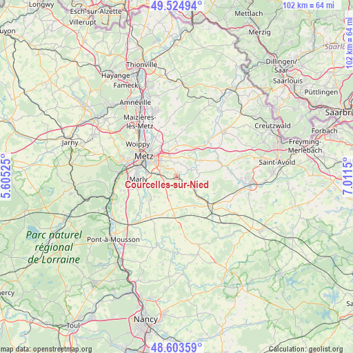
Courcelles-sur-Nied GPS coordinates[2]
49° 3' 59.04" North, 6° 18' 30.168" East
| Map corner | latitude | longitude |
|---|---|---|
| Upper-left | 49.52494°, | 5.60525° |
| Center: | 49.0664°, | 6.30838° |
| Lower-right: | 48.60359°, | 7.0115° |
| Map W x H: | 102.4×102.4 km | = 63.6×63.6mi |
| max Lat: | 51.07786° ⇑18.8% North |
| Courcelles-sur-Nied: | 49.0664° |
| min Lat: | ⇓81.2% South 41.3874° |
| min Long | Courcelles-sur- | max Long |
| -5.08615° | 6.30838° | 9.52242° |
| W 90.3%⇐ | ⇒9.7% E |
Elevation
Elevation of Courcelles-sur-Nied is 222 m = 728 ft, and this is 28.3 m = 93 ft above average elevation for this country.
| Max E: |
2333 m = 7654 ft | 29.4% |
| Courcelles-sur-Nied | 222 m 728 ft | |
| Avg. | 193.7 m = 635 ft | |
Min E: |
-1 m = -3 ft | 70.6% |
See also: France elevation on elevation.city.
Geographical zone
Courcelles-sur-Nied is located in North temperate zone (between Tropic of Cancer and the Arctic Circle). Distance of this North polar circle is 1945.5 km =1208.9 mi to North.| Distance of | km | miles | from Courcelles-sur-Nied |
|---|---|---|---|
| North Pole | 4551.4 | 2828.1 | to North |
| Arctic Circle | 1945.5 | 1208.9 | to North |
| Tropic Cancer | 2849.8 | 1770.8 | to South |
| Equator | 5455.7 | 3390 | to South |


Nearby cities:
15 places around Courcelles-sur-Nied: (largest is in red/bold)
• Ars-Laquenexy
4.1 km =2.5 mi,  317°
317°
• Courcelles-Chaussy
8.3 km =5.2 mi,  54°
54°
• Fleury
8.8 km =5.5 mi,  251°
251°
• Jury
4.1 km =2.5 mi,  275°
275°
• Laquenexy
1.4 km =0.9 mi,  18°
18°
• Mécleuves
3.7 km =2.3 mi,  228°
228°
• Noisseville
7.9 km =4.9 mi,  341°
341°
• Pange
4 km =2.5 mi,  57°
57°
• Peltre
6 km =3.7 mi, 278°
• Pouilly
9.1 km =5.7 mi,  258°
258°
• Retonfey
7.8 km =4.8 mi,  358°
358°
• Rémilly
8.5 km =5.3 mi,  133°
133°
• Silly-sur-Nied
7 km =4.3 mi,  31°
31°
• Vantoux
8.9 km =5.5 mi, 321°
• Verny
10.1 km =6.3 mi, 229°
Sources, notices
• [Note1] Compared only with cities in France existing in our database
• [Src1] Map data: © OpenStreetMap contributors (CC-BY-SA)
• [Src2] Other city data from geonames.org with taken over terms of usage.
• [Src3] Geographical zone / Annual Mean Temperature by Robert A. Rohde @ Wikipedia
