Péaule geodata
Péaule (Brittany) is a populated place; located in France in Europe/Paris (GMT+2) time zone. With population of 2,362 people, there are 4092 cities with bigger population in this country. Compared to other cities in France, 52.4% of cities are located further ↓South; 95.9% of cities are located further →East and 66.6% of cities have higher elevation than Péaule. Note1
Administrative division(s):
- Level 1: Brittany
- Level 2: Morbihan
- Level 3: Arrondissement de Vannes
- Level 4: Péaule


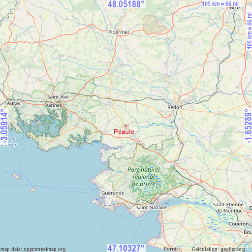
Péaule GPS coordinates[2]
47° 34' 46.992" North, 2° 21' 21.636" West
| Map corner | latitude | longitude |
|---|---|---|
| Upper-left | 48.05188°, | -3.05914° |
| Center: | 47.57972°, | -2.35601° |
| Lower-right: | 47.10327°, | -1.65289° |
| Map W x H: | 105.5×105.5 km | = 65.6×65.6mi |
| max Lat: | 51.07786° ⇑47.6% North |
| Péaule: | 47.57972° |
| min Lat: | ⇓52.4% South 41.3874° |
| min Long | Péaule | max Long |
| -5.08615° | -2.35601° | 9.52242° |
| W 4.1%⇐ | ⇒95.9% E |
Elevation
Elevation of Péaule is 86 m = 282 ft, and this is 107.7 m = 353 ft below average elevation for this country.
| Max E: |
2333 m = 7654 ft | 66.6% |
| Avg. | 193.7 m = 635 ft | |
| Péaule | 86 m = 282 ft | |
Min E: |
-1 m = -3 ft | 33.4% |
See also: France elevation on elevation.city.
Geographical zone
Péaule is located in North temperate zone (between Tropic of Cancer and the Arctic Circle). Distance of this North polar circle is 2110.8 km =1311.6 mi to North.| Distance of | km | miles | from Péaule |
|---|---|---|---|
| North Pole | 4716.7 | 2930.8 | to North |
| Arctic Circle | 2110.8 | 1311.6 | to North |
| Tropic Cancer | 2684.4 | 1668 | to South |
| Equator | 5290.4 | 3287.3 | to South |


Nearby cities:
15 places around Péaule: (largest is in red/bold)
• Arzal
7.2 km =4.5 mi,  192°
192°
• Billiers
11.3 km =7 mi,  241°
241°
• Béganne
8.8 km =5.5 mi,  77°
77°
• Caden
7.7 km =4.8 mi,  42°
42°
• Camoël
11.3 km =7 mi,  195°
195°
• Férel
10.9 km =6.8 mi,  174°
174°
• La Roche-Bernard
7.9 km =4.9 mi,  148°
148°
• Le Guerno
3.9 km =2.4 mi,  275°
275°
• Limerzel
6.3 km =3.9 mi,  1°
1°
• Malansac
11.8 km =7.3 mi,  22°
22°
• Marzan
4.9 km =3 mi, 151°
• Muzillac
9.7 km =6 mi,  253°
253°
• Nivillac
7.5 km =4.7 mi,  133°
133°
• Noyal-Muzillac
7.6 km =4.7 mi, 280°
• Questembert
11.7 km =7.3 mi,  322°
322°
Sources, notices
• [Note1] Compared only with cities in France existing in our database
• [Src1] Map data: © OpenStreetMap contributors (CC-BY-SA)
• [Src2] Other city data from geonames.org with taken over terms of usage.
• [Src3] Geographical zone / Annual Mean Temperature by Robert A. Rohde @ Wikipedia
