Arzal geodata
Arzal (Brittany) is a populated place; located in France in Europe/Paris (GMT+2) time zone. With population of 986 people, there are 8936 cities with bigger population in this country. Compared to other cities in France, 51.4% of cities are located further ↓South; 96% of cities are located further →East and 83.8% of cities have higher elevation than Arzal. Note1
Administrative division(s):
- Level 1: Brittany
- Level 2: Morbihan
- Level 3: Arrondissement de Vannes
- Level 4: Arzal


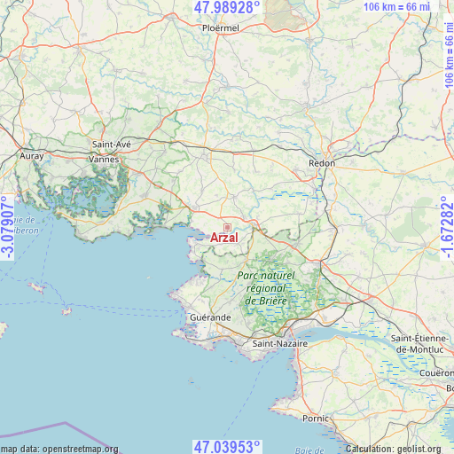
Arzal GPS coordinates[2]
47° 30' 59.58" North, 2° 22' 33.42" West
| Map corner | latitude | longitude |
|---|---|---|
| Upper-left | 47.98928°, | -3.07907° |
| Center: | 47.51655°, | -2.37595° |
| Lower-right: | 47.03953°, | -1.67282° |
| Map W x H: | 105.6×105.6 km | = 65.6×65.6mi |
| max Lat: | 51.07786° ⇑48.6% North |
| Arzal: | 47.51655° |
| min Lat: | ⇓51.4% South 41.3874° |
| min Long | Arzal | max Long |
| -5.08615° | -2.37595° | 9.52242° |
| W 4%⇐ | ⇒96% E |
Elevation
Elevation of Arzal is 45 m = 148 ft, and this is 148.7 m = 488 ft below average elevation for this country.
| Max E: |
2333 m = 7654 ft | 83.8% |
| Avg. | 193.7 m = 635 ft | |
| Arzal | 45 m = 148 ft | |
Min E: |
-1 m = -3 ft | 16.2% |
See also: France elevation on elevation.city.
Geographical zone
Arzal is located in North temperate zone (between Tropic of Cancer and the Arctic Circle). Distance of this North polar circle is 2117.8 km =1315.9 mi to North.| Distance of | km | miles | from Arzal |
|---|---|---|---|
| North Pole | 4723.7 | 2935.2 | to North |
| Arctic Circle | 2117.8 | 1315.9 | to North |
| Tropic Cancer | 2677.4 | 1663.7 | to South |
| Equator | 5283.3 | 3282.9 | to South |


Nearby cities:
15 places around Arzal: (largest is in red/bold)
• Assérac
9.8 km =6.1 mi,  185°
185°
• Billiers
8.6 km =5.3 mi,  280°
280°
• Camoël
4.2 km =2.6 mi,  200°
200°
• Férel
4.6 km =2.9 mi,  146°
146°
• Herbignac
8.8 km =5.5 mi, 150°
• La Chapelle-des-Marais
12.8 km =8 mi,  126°
126°
• La Roche-Bernard
5.6 km =3.5 mi,  87°
87°
• Le Guerno
7.8 km =4.8 mi,  342°
342°
• Limerzel
13.4 km =8.3 mi,  6°
6°
• Marzan
4.7 km =2.9 mi,  55°
55°
• Muzillac
8.9 km =5.5 mi,  298°
298°
• Nivillac
7.2 km =4.5 mi,  74°
74°
• Noyal-Muzillac
10.3 km =6.4 mi,  324°
324°
• Péaule
7.2 km =4.5 mi, 12°
• Pénestin
8.2 km =5.1 mi,  242°
242°
Sources, notices
• [Note1] Compared only with cities in France existing in our database
• [Src1] Map data: © OpenStreetMap contributors (CC-BY-SA)
• [Src2] Other city data from geonames.org with taken over terms of usage.
• [Src3] Geographical zone / Annual Mean Temperature by Robert A. Rohde @ Wikipedia
