Payrac geodata
Payrac (Occitanie) is a populated place; located in France in Europe/Paris (GMT+2) time zone. With population of 616 people, there are 13048 cities with bigger population in this country. Compared to other cities in France, 81.4% of cities are located further ↑North; 63.4% of cities are located further →East and 79.4% of cities have lower elevation than Payrac. Note1
Administrative division(s):
- Level 1: Occitanie
- Level 2: Lot
- Level 3: Arrondissement de Gourdon
- Level 4: Payrac


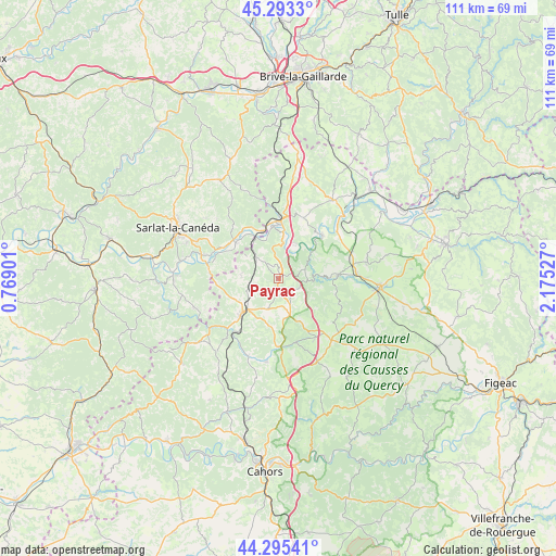
Payrac GPS coordinates[2]
44° 47' 47.436" North, 1° 28' 19.704" East
| Map corner | latitude | longitude |
|---|---|---|
| Upper-left | 45.2933°, | 0.76901° |
| Center: | 44.79651°, | 1.47214° |
| Lower-right: | 44.29541°, | 2.17527° |
| Map W x H: | 111×111 km | = 69×69mi |
| max Lat: | 51.07786° ⇑81.4% North |
| Payrac: | 44.79651° |
| min Lat: | ⇓18.6% South 41.3874° |
| min Long | Payrac | max Long |
| -5.08615° | 1.47214° | 9.52242° |
| W 36.6%⇐ | ⇒63.4% E |
Elevation
Elevation of Payrac is 284 m = 932 ft, and this is 90.3 m = 296 ft above average elevation for this country.
| Max E: |
2333 m = 7654 ft | 20.6% |
| Payrac | 284 m 932 ft | |
| Avg. | 193.7 m = 635 ft | |
Min E: |
-1 m = -3 ft | 79.4% |
See also: France elevation on elevation.city.
Geographical zone
Payrac is located in North temperate zone (between Tropic of Cancer and the Arctic Circle). Distance of this Northern Tropic circle is 2375 km =1475.8 mi to South.| Distance of | km | miles | from Payrac |
|---|---|---|---|
| North Pole | 5026.2 | 3123.1 | to North |
| Arctic Circle | 2420.3 | 1503.9 | to North |
| Tropic Cancer | 2375 | 1475.8 | to South |
| Equator | 4980.9 | 3095 | to South |


Nearby cities:
15 places around Payrac: (largest is in red/bold)
• Alvignac
17.9 km =11.1 mi,  79°
79°
• Carlux
13.6 km =8.5 mi,  315°
315°
• Gourdon
9.6 km =6 mi,  226°
226°
• Groléjac
14.5 km =9 mi,  280°
280°
• Lachapelle-Auzac
14.8 km =9.2 mi,  6°
6°
• Lanzac
8.7 km =5.4 mi, 5°
• Le Vigan
6.7 km =4.2 mi,  202°
202°
• Montfaucon
14 km =8.7 mi,  149°
149°
• Payrignac
10.6 km =6.6 mi,  244°
244°
• Pinsac
7.3 km =4.5 mi,  26°
26°
• Rocamadour
11.6 km =7.2 mi,  87°
87°
• Saint-Germain-du-Bel-Air
16.8 km =10.4 mi,  188°
188°
• Saint-Julien-de-Lampon
12.4 km =7.7 mi,  309°
309°
• Saint-Martial-de-Nabirat
17.8 km =11.1 mi,  251°
251°
• Souillac
11.2 km =7 mi,  0°
0°
Sources, notices
• [Note1] Compared only with cities in France existing in our database
• [Src1] Map data: © OpenStreetMap contributors (CC-BY-SA)
• [Src2] Other city data from geonames.org with taken over terms of usage.
• [Src3] Geographical zone / Annual Mean Temperature by Robert A. Rohde @ Wikipedia
