Rocamadour geodata
Rocamadour (Occitanie) is a populated place; located in France in Europe/Paris (GMT+2) time zone. With population of 663 people, there are 12328 cities with bigger population in this country. Compared to other cities in France, 81.4% of cities are located further ↑North; 61.4% of cities are located further →East and 60.9% of cities have lower elevation than Rocamadour. Note1
Administrative division(s):
- Level 1: Occitanie
- Level 2: Lot
- Level 3: Arrondissement de Gourdon
- Level 4: Rocamadour


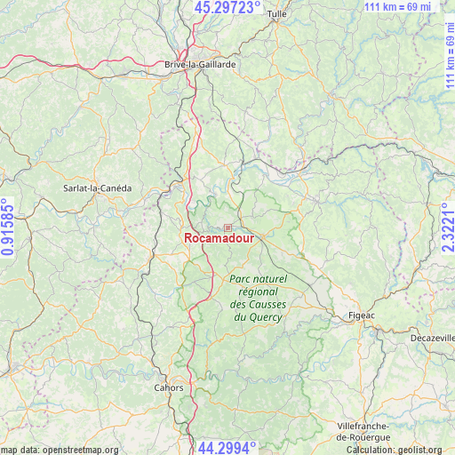
Rocamadour GPS coordinates[2]
44° 48' 1.692" North, 1° 37' 8.328" East
| Map corner | latitude | longitude |
|---|---|---|
| Upper-left | 45.29723°, | 0.91585° |
| Center: | 44.80047°, | 1.61898° |
| Lower-right: | 44.2994°, | 2.3221° |
| Map W x H: | 110.9×110.9 km | = 68.9×68.9mi |
| max Lat: | 51.07786° ⇑81.4% North |
| Rocamadour: | 44.80047° |
| min Lat: | ⇓18.6% South 41.3874° |
| min Long | Rocamadour | max Long |
| -5.08615° | 1.61898° | 9.52242° |
| W 38.6%⇐ | ⇒61.4% E |
Elevation
Elevation of Rocamadour is 174 m = 571 ft, and this is 19.7 m = 65 ft below average elevation for this country.
| Max E: |
2333 m = 7654 ft | 39.1% |
| Avg. | 193.7 m = 635 ft | |
| Rocamadour | 174 m = 571 ft | |
Min E: |
-1 m = -3 ft | 60.9% |
See also: France elevation on elevation.city.
Geographical zone
Rocamadour is located in North temperate zone (between Tropic of Cancer and the Arctic Circle). Distance of this Northern Tropic circle is 2375.4 km =1476 mi to South.| Distance of | km | miles | from Rocamadour |
|---|---|---|---|
| North Pole | 5025.7 | 3122.8 | to North |
| Arctic Circle | 2419.8 | 1503.6 | to North |
| Tropic Cancer | 2375.4 | 1476 | to South |
| Equator | 4981.3 | 3095.2 | to South |


Nearby cities:
15 places around Rocamadour: (largest is in red/bold)
• Alvignac
6.7 km =4.2 mi,  63°
63°
• Aynac
18.5 km =11.5 mi,  95°
95°
• Bétaille
18.4 km =11.4 mi,  29°
29°
• Gramat
8.2 km =5.1 mi,  105°
105°
• Labastide-Murat
17.5 km =10.9 mi,  193°
193°
• Lachapelle-Auzac
17.4 km =10.8 mi,  324°
324°
• Lanzac
13.4 km =8.3 mi,  307°
307°
• Le Vigan
15.6 km =9.7 mi,  244°
244°
• Martel
15.2 km =9.4 mi,  356°
356°
• Montfaucon
13.4 km =8.3 mi,  199°
199°
• Payrac
11.6 km =7.2 mi,  267°
267°
• Pinsac
10.3 km =6.4 mi, 306°
• Puybrun
18.7 km =11.6 mi,  45°
45°
• Souillac
15.8 km =9.8 mi, 312°
• Vayrac
18.3 km =11.4 mi,  21°
21°
Sources, notices
• [Note1] Compared only with cities in France existing in our database
• [Src1] Map data: © OpenStreetMap contributors (CC-BY-SA)
• [Src2] Other city data from geonames.org with taken over terms of usage.
• [Src3] Geographical zone / Annual Mean Temperature by Robert A. Rohde @ Wikipedia
