Panissières geodata
Panissières (Auvergne-Rhône-Alpes) is a populated place; located in France in Europe/Paris (GMT+2) time zone. With population of 2,850 people, there are 3422 cities with bigger population in this country. Compared to other cities in France, 69.4% of cities are located further ↑North; 70.9% of cities are located further ←West and 95.4% of cities have lower elevation than Panissières. Note1
Administrative division(s):
- Level 1: Auvergne-Rhône-Alpes
- Level 2: Département de la Loire
- Level 3: Arrondissement de Montbrison
- Level 4: Panissières


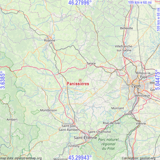
Panissières GPS coordinates[2]
45° 47' 30.66" North, 4° 20' 29.868" East
| Map corner | latitude | longitude |
|---|---|---|
| Upper-left | 46.27996°, | 3.6385° |
| Center: | 45.79185°, | 4.34163° |
| Lower-right: | 45.29943°, | 5.04475° |
| Map W x H: | 109×109 km | = 67.7×67.7mi |
| max Lat: | 51.07786° ⇑69.4% North |
| Panissières: | 45.79185° |
| min Lat: | ⇓30.6% South 41.3874° |
| min Long | Panissières | max Long |
| -5.08615° | 4.34163° | 9.52242° |
| W 70.9%⇐ | ⇒29.1% E |
Elevation
Elevation of Panissières is 606 m = 1988 ft, and this is 412.3 m = 1353 ft above average elevation for this country.
| Max E: |
2333 m = 7654 ft | 4.6% |
| Panissières | 606 m 1988 ft | |
| Avg. | 193.7 m = 635 ft | |
Min E: |
-1 m = -3 ft | 95.4% |
See also: France elevation on elevation.city.
Geographical zone
Panissières is located in North temperate zone (between Tropic of Cancer and the Arctic Circle). Distance of this North polar circle is 2309.6 km =1435.1 mi to North.| Distance of | km | miles | from Panissières |
|---|---|---|---|
| North Pole | 4915.5 | 3054.3 | to North |
| Arctic Circle | 2309.6 | 1435.1 | to North |
| Tropic Cancer | 2485.7 | 1544.5 | to South |
| Equator | 5091.6 | 3163.8 | to South |


Nearby cities:
15 places around Panissières: (largest is in red/bold)
• Bussières
7.3 km =4.5 mi,  311°
311°
• Chambost-Longessaigne
3 km =1.9 mi,  134°
134°
• Civens
7.1 km =4.4 mi,  258°
258°
• Cottance
3.3 km =2.1 mi,  272°
272°
• Haute-Rivoire
9.5 km =5.9 mi,  153°
153°
• Longessaigne
6.4 km =4 mi,  90°
90°
• Montrottier
9.7 km =6 mi, 91°
• Néronde
9.6 km =6 mi,  301°
301°
• Pouilly-lès-Feurs
8.5 km =5.3 mi, 274°
• Rozier-en-Donzy
5.1 km =3.2 mi,  281°
281°
• Saint-Barthélemy-Lestra
8.2 km =5.1 mi,  180°
180°
• Saint-Clément-les-Places
7.7 km =4.8 mi,  124°
124°
• Saint-Martin-Lestra
8 km =5 mi,  172°
172°
• Villechenève
5.5 km =3.4 mi,  65°
65°
• Violay
7 km =4.3 mi,  11°
11°
Sources, notices
• [Note1] Compared only with cities in France existing in our database
• [Src1] Map data: © OpenStreetMap contributors (CC-BY-SA)
• [Src2] Other city data from geonames.org with taken over terms of usage.
• [Src3] Geographical zone / Annual Mean Temperature by Robert A. Rohde @ Wikipedia
