Rozier-en-Donzy geodata
Rozier-en-Donzy (Auvergne-Rhône-Alpes) is a populated place; located in France in Europe/Paris (GMT+2) time zone. With population of 1,335 people, there are 6877 cities with bigger population in this country. Compared to other cities in France, 69.3% of cities are located further ↑North; 70.4% of cities are located further ←West and 92.9% of cities have lower elevation than Rozier-en-Donzy. Note1
Administrative division(s):
- Level 1: Auvergne-Rhône-Alpes
- Level 2: Département de la Loire
- Level 3: Arrondissement de Montbrison
- Level 4: Rozier-en-Donzy


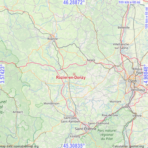
Rozier-en-Donzy GPS coordinates[2]
45° 48' 2.484" North, 4° 16' 38.496" East
| Map corner | latitude | longitude |
|---|---|---|
| Upper-left | 46.28872°, | 3.57423° |
| Center: | 45.80069°, | 4.27736° |
| Lower-right: | 45.30835°, | 4.98048° |
| Map W x H: | 109×109 km | = 67.7×67.7mi |
| max Lat: | 51.07786° ⇑69.3% North |
| Rozier-en-Donzy: | 45.80069° |
| min Lat: | ⇓30.7% South 41.3874° |
| min Long | Rozier-en-Donzy | max Long |
| -5.08615° | 4.27736° | 9.52242° |
| W 70.4%⇐ | ⇒29.6% E |
Elevation
Elevation of Rozier-en-Donzy is 501 m = 1644 ft, and this is 307.3 m = 1008 ft above average elevation for this country.
| Max E: |
2333 m = 7654 ft | 7.1% |
| Rozier-en-Donzy | 501 m 1644 ft | |
| Avg. | 193.7 m = 635 ft | |
Min E: |
-1 m = -3 ft | 92.9% |
See also: France elevation on elevation.city.
Geographical zone
Rozier-en-Donzy is located in North temperate zone (between Tropic of Cancer and the Arctic Circle). Distance of this North polar circle is 2308.6 km =1434.5 mi to North.| Distance of | km | miles | from Rozier-en-Donzy |
|---|---|---|---|
| North Pole | 4914.5 | 3053.7 | to North |
| Arctic Circle | 2308.6 | 1434.5 | to North |
| Tropic Cancer | 2486.6 | 1545.1 | to South |
| Equator | 5092.6 | 3164.4 | to South |


Nearby cities:
15 places around Rozier-en-Donzy: (largest is in red/bold)
• Balbigny
7.1 km =4.4 mi,  286°
286°
• Bussières
3.9 km =2.4 mi,  353°
353°
• Chambost-Longessaigne
7.8 km =4.8 mi,  113°
113°
• Civens
3.1 km =1.9 mi,  220°
220°
• Cottance
1.9 km =1.2 mi,  116°
116°
• Feurs
8.4 km =5.2 mi,  207°
207°
• Nervieux
9.8 km =6.1 mi,  271°
271°
• Néronde
5.1 km =3.2 mi,  321°
321°
• Panissières
5.1 km =3.2 mi,  101°
101°
• Pouilly-lès-Feurs
3.5 km =2.2 mi,  264°
264°
• Saint-Barthélemy-Lestra
10.4 km =6.5 mi,  151°
151°
• Saint-Marcel-de-Félines
10 km =6.2 mi, 318°
• Villechenève
10.1 km =6.3 mi,  82°
82°
• Violay
8.6 km =5.3 mi,  47°
47°
• Épercieux-Saint-Paul
5.4 km =3.4 mi, 257°
Sources, notices
• [Note1] Compared only with cities in France existing in our database
• [Src1] Map data: © OpenStreetMap contributors (CC-BY-SA)
• [Src2] Other city data from geonames.org with taken over terms of usage.
• [Src3] Geographical zone / Annual Mean Temperature by Robert A. Rohde @ Wikipedia
