Cottance geodata
Cottance (Auvergne-Rhône-Alpes) is a populated place; located in France in Europe/Paris (GMT+2) time zone. With population of 559 people, there are 14019 cities with bigger population in this country. Compared to other cities in France, 69.4% of cities are located further ↑North; 70.6% of cities are located further ←West and 94.3% of cities have lower elevation than Cottance. Note1
Administrative division(s):
- Level 1: Auvergne-Rhône-Alpes
- Level 2: Département de la Loire
- Level 3: Arrondissement de Montbrison
- Level 4: Cottance


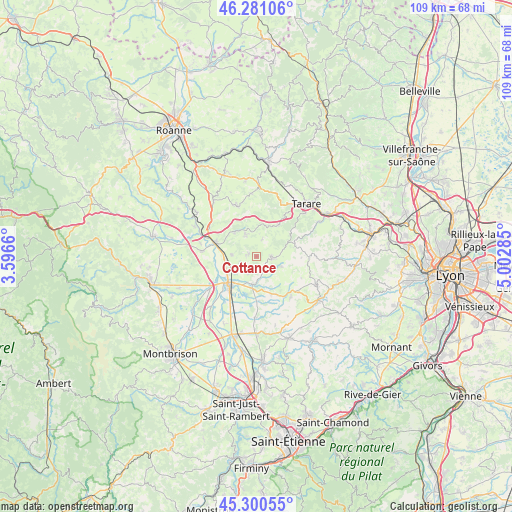
Cottance GPS coordinates[2]
45° 47' 34.656" North, 4° 17' 58.992" East
| Map corner | latitude | longitude |
|---|---|---|
| Upper-left | 46.28106°, | 3.5966° |
| Center: | 45.79296°, | 4.29972° |
| Lower-right: | 45.30055°, | 5.00285° |
| Map W x H: | 109×109 km | = 67.7×67.7mi |
| max Lat: | 51.07786° ⇑69.4% North |
| Cottance: | 45.79296° |
| min Lat: | ⇓30.6% South 41.3874° |
| min Long | Cottance | max Long |
| -5.08615° | 4.29972° | 9.52242° |
| W 70.6%⇐ | ⇒29.4% E |
Elevation
Elevation of Cottance is 554 m = 1818 ft, and this is 360.3 m = 1182 ft above average elevation for this country.
| Max E: |
2333 m = 7654 ft | 5.7% |
| Cottance | 554 m 1818 ft | |
| Avg. | 193.7 m = 635 ft | |
Min E: |
-1 m = -3 ft | 94.3% |
See also: France elevation on elevation.city.
Geographical zone
Cottance is located in North temperate zone (between Tropic of Cancer and the Arctic Circle). Distance of this North polar circle is 2309.5 km =1435.1 mi to North.| Distance of | km | miles | from Cottance |
|---|---|---|---|
| North Pole | 4915.4 | 3054.3 | to North |
| Arctic Circle | 2309.5 | 1435.1 | to North |
| Tropic Cancer | 2485.8 | 1544.6 | to South |
| Equator | 5091.7 | 3163.8 | to South |


Nearby cities:
15 places around Cottance: (largest is in red/bold)
• Balbigny
9 km =5.6 mi,  288°
288°
• Bussières
5.2 km =3.2 mi,  335°
335°
• Chambost-Longessaigne
5.8 km =3.6 mi,  112°
112°
• Civens
4 km =2.5 mi,  248°
248°
• Feurs
8.7 km =5.4 mi,  220°
220°
• Néronde
6.9 km =4.3 mi,  314°
314°
• Panissières
3.3 km =2.1 mi,  92°
92°
• Pouilly-lès-Feurs
5.2 km =3.2 mi,  275°
275°
• Rozier-en-Donzy
1.9 km =1.2 mi,  296°
296°
• Saint-Barthélemy-Lestra
8.9 km =5.5 mi,  159°
159°
• Saint-Martin-Lestra
9.2 km =5.7 mi,  152°
152°
• Valeille
9.4 km =5.8 mi,  178°
178°
• Villechenève
8.5 km =5.3 mi,  75°
75°
• Violay
8.2 km =5.1 mi,  34°
34°
• Épercieux-Saint-Paul
7 km =4.3 mi,  267°
267°
Sources, notices
• [Note1] Compared only with cities in France existing in our database
• [Src1] Map data: © OpenStreetMap contributors (CC-BY-SA)
• [Src2] Other city data from geonames.org with taken over terms of usage.
• [Src3] Geographical zone / Annual Mean Temperature by Robert A. Rohde @ Wikipedia
