Ourton geodata
Ourton (Hauts-de-France) is a populated place; located in France in Europe/Paris (GMT+2) time zone. With population of 718 people, there are 11561 cities with bigger population in this country. Compared to other cities in France, 96.9% of cities are located further ↓South; 50.3% of cities are located further ←West and 68.7% of cities have higher elevation than Ourton. Note1
Administrative division(s):
- Level 1: Hauts-de-France
- Level 2: Pas-de-Calais
- Level 3: Arrondissement de Béthune
- Level 4: Ourton


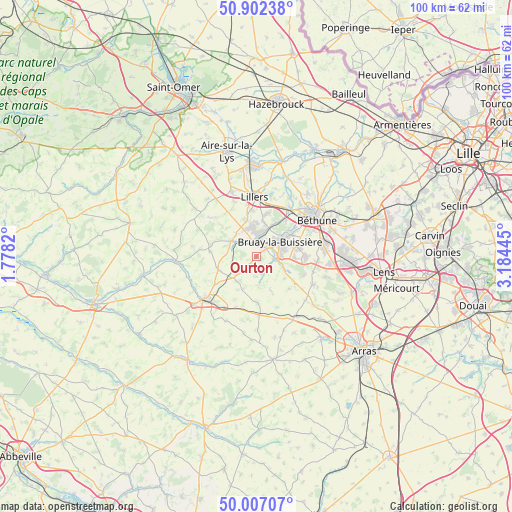
Ourton GPS coordinates[2]
50° 27' 24.624" North, 2° 28' 52.752" East
| Map corner | latitude | longitude |
|---|---|---|
| Upper-left | 50.90238°, | 1.7782° |
| Center: | 50.45684°, | 2.48132° |
| Lower-right: | 50.00707°, | 3.18445° |
| Map W x H: | 99.5×99.5 km | = 61.8×61.8mi |
| max Lat: | 51.07786° ⇑3.1% North |
| Ourton: | 50.45684° |
| min Lat: | ⇓96.9% South 41.3874° |
| min Long | Ourton | max Long |
| -5.08615° | 2.48132° | 9.52242° |
| W 50.3%⇐ | ⇒49.7% E |
Elevation
Elevation of Ourton is 81 m = 266 ft, and this is 112.7 m = 370 ft below average elevation for this country.
| Max E: |
2333 m = 7654 ft | 68.7% |
| Avg. | 193.7 m = 635 ft | |
| Ourton | 81 m = 266 ft | |
Min E: |
-1 m = -3 ft | 31.3% |
See also: France elevation on elevation.city.
Geographical zone
Ourton is located in North temperate zone (between Tropic of Cancer and the Arctic Circle). Distance of this North polar circle is 1790.9 km =1112.8 mi to North.| Distance of | km | miles | from Ourton |
|---|---|---|---|
| North Pole | 4396.8 | 2732 | to North |
| Arctic Circle | 1790.9 | 1112.8 | to North |
| Tropic Cancer | 3004.4 | 1866.8 | to South |
| Equator | 5610.3 | 3486.1 | to South |


Nearby cities:
15 places around Ourton: (largest is in red/bold)
• Auchel
5.2 km =3.2 mi,  353°
353°
• Bours
5.1 km =3.2 mi,  265°
265°
• Bruay-la-Buissière
5.7 km =3.5 mi,  58°
58°
• Calonne-Ricouart
3.2 km =2 mi, 349°
• Camblain-Châtelain
3.5 km =2.2 mi,  328°
328°
• Cauchy-à-la-Tour
5.8 km =3.6 mi, 334°
• Divion
2.4 km =1.5 mi,  45°
45°
• Diéval
3.3 km =2.1 mi,  222°
222°
• Floringhem
5.9 km =3.7 mi,  317°
317°
• Houdain
4.1 km =2.5 mi,  100°
100°
• La Comté
3.5 km =2.2 mi,  167°
167°
• Magnicourt-en-Comte
6.5 km =4 mi, 168°
• Marles-les-Mines
5.7 km =3.5 mi,  20°
20°
• Pernes
5.8 km =3.6 mi,  302°
302°
• Ranchicourt
5.8 km =3.6 mi,  113°
113°
Sources, notices
• [Note1] Compared only with cities in France existing in our database
• [Src1] Map data: © OpenStreetMap contributors (CC-BY-SA)
• [Src2] Other city data from geonames.org with taken over terms of usage.
• [Src3] Geographical zone / Annual Mean Temperature by Robert A. Rohde @ Wikipedia
