Floringhem geodata
Floringhem (Hauts-de-France) is a populated place; located in France in Europe/Paris (GMT+2) time zone. With population of 769 people, there are 10958 cities with bigger population in this country. Compared to other cities in France, 97.3% of cities are located further ↓South; 50.6% of cities are located further →East and 54.8% of cities have higher elevation than Floringhem. Note1
Administrative division(s):
- Level 1: Hauts-de-France
- Level 2: Pas-de-Calais
- Level 3: Arras
- Level 4: Floringhem


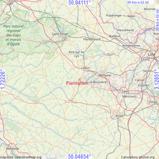
Floringhem GPS coordinates[2]
50° 29' 45.384" North, 2° 25' 31.368" East
| Map corner | latitude | longitude |
|---|---|---|
| Upper-left | 50.94111°, | 1.72226° |
| Center: | 50.49594°, | 2.42538° |
| Lower-right: | 50.04654°, | 3.12851° |
| Map W x H: | 99.5×99.5 km | = 61.8×61.8mi |
| max Lat: | 51.07786° ⇑2.7% North |
| Floringhem: | 50.49594° |
| min Lat: | ⇓97.3% South 41.3874° |
| min Long | Floringhem | max Long |
| -5.08615° | 2.42538° | 9.52242° |
| W 49.4%⇐ | ⇒50.6% E |
Elevation
Elevation of Floringhem is 117 m = 384 ft, and this is 76.7 m = 252 ft below average elevation for this country.
| Max E: |
2333 m = 7654 ft | 54.8% |
| Avg. | 193.7 m = 635 ft | |
| Floringhem | 117 m = 384 ft | |
Min E: |
-1 m = -3 ft | 45.2% |
See also: France elevation on elevation.city.
Geographical zone
Floringhem is located in North temperate zone (between Tropic of Cancer and the Arctic Circle). Distance of this North polar circle is 1786.6 km =1110.1 mi to North.| Distance of | km | miles | from Floringhem |
|---|---|---|---|
| North Pole | 4392.4 | 2729.3 | to North |
| Arctic Circle | 1786.6 | 1110.1 | to North |
| Tropic Cancer | 3008.7 | 1869.5 | to South |
| Equator | 5614.6 | 3488.7 | to South |


Nearby cities:
15 places around Floringhem: (largest is in red/bold)
• Allouagne
7.3 km =4.5 mi,  57°
57°
• Ames
5 km =3.1 mi,  351°
351°
• Auchel
3.5 km =2.2 mi,  76°
76°
• Bours
4.8 km =3 mi,  193°
193°
• Burbure
5.5 km =3.4 mi,  34°
34°
• Calonne-Ricouart
3.6 km =2.2 mi,  109°
109°
• Camblain-Châtelain
2.5 km =1.6 mi,  123°
123°
• Cauchy-à-la-Tour
1.7 km =1.1 mi, 58°
• Divion
6.3 km =3.9 mi, 115°
• Diéval
7 km =4.3 mi,  165°
165°
• Ferfay
2.5 km =1.6 mi,  358°
358°
• Lozinghem
5.8 km =3.6 mi,  68°
68°
• Marles-les-Mines
6 km =3.7 mi, 80°
• Ourton
5.9 km =3.7 mi,  137°
137°
• Pernes
1.6 km =1 mi,  215°
215°
Sources, notices
• [Note1] Compared only with cities in France existing in our database
• [Src1] Map data: © OpenStreetMap contributors (CC-BY-SA)
• [Src2] Other city data from geonames.org with taken over terms of usage.
• [Src3] Geographical zone / Annual Mean Temperature by Robert A. Rohde @ Wikipedia
