Auchel geodata
Auchel (Hauts-de-France) is a populated place; located in France in Europe/Paris (GMT+2) time zone. With population of 11,419 people, there are 845 cities with bigger population in this country. Compared to other cities in France, 97.3% of cities are located further ↓South; 50.2% of cities are located further ←West and 61.2% of cities have higher elevation than Auchel. Note1
Administrative division(s):
- Level 1: Hauts-de-France
- Level 2: Pas-de-Calais
- Level 3: Arrondissement de Béthune
- Level 4: Auchel


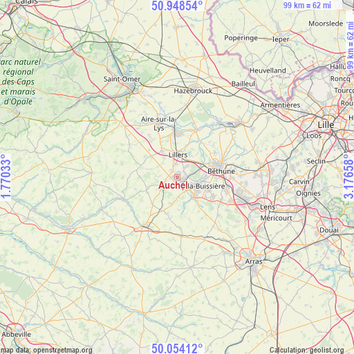
Auchel GPS coordinates[2]
50° 30' 12.42" North, 2° 28' 24.456" East
| Map corner | latitude | longitude |
|---|---|---|
| Upper-left | 50.94854°, | 1.77033° |
| Center: | 50.50345°, | 2.47346° |
| Lower-right: | 50.05412°, | 3.17658° |
| Map W x H: | 99.5×99.4 km | = 61.8×61.8mi |
| max Lat: | 51.07786° ⇑2.7% North |
| Auchel: | 50.50345° |
| min Lat: | ⇓97.3% South 41.3874° |
| min Long | Auchel | max Long |
| -5.08615° | 2.47346° | 9.52242° |
| W 50.2%⇐ | ⇒49.8% E |
Elevation
Elevation of Auchel is 99 m = 325 ft, and this is 94.7 m = 311 ft below average elevation for this country.
| Max E: |
2333 m = 7654 ft | 61.2% |
| Avg. | 193.7 m = 635 ft | |
| Auchel | 99 m = 325 ft | |
Min E: |
-1 m = -3 ft | 38.8% |
See also: France elevation on elevation.city.
Geographical zone
Auchel is located in North temperate zone (between Tropic of Cancer and the Arctic Circle). Distance of this North polar circle is 1785.7 km =1109.6 mi to North.| Distance of | km | miles | from Auchel |
|---|---|---|---|
| North Pole | 4391.6 | 2728.8 | to North |
| Arctic Circle | 1785.7 | 1109.6 | to North |
| Tropic Cancer | 3009.5 | 1870 | to South |
| Equator | 5615.5 | 3489.3 | to South |


Nearby cities:
15 places around Auchel: (largest is in red/bold)
• Allouagne
4.2 km =2.6 mi,  40°
40°
• Ames
5.9 km =3.7 mi,  315°
315°
• Bruay-la-Buissière
5.9 km =3.7 mi,  112°
112°
• Burbure
3.7 km =2.3 mi,  355°
355°
• Calonne-Ricouart
2 km =1.2 mi,  180°
180°
• Camblain-Châtelain
2.6 km =1.6 mi,  210°
210°
• Cauchy-à-la-Tour
1.9 km =1.2 mi,  271°
271°
• Divion
4.2 km =2.6 mi,  147°
147°
• Ferfay
3.8 km =2.4 mi,  295°
295°
• Floringhem
3.5 km =2.2 mi,  256°
256°
• Lapugnoy
4.6 km =2.9 mi,  71°
71°
• Lozinghem
2.4 km =1.5 mi,  56°
56°
• Marles-les-Mines
2.5 km =1.6 mi,  86°
86°
• Ourton
5.2 km =3.2 mi,  173°
173°
• Pernes
4.8 km =3 mi,  243°
243°
Sources, notices
• [Note1] Compared only with cities in France existing in our database
• [Src1] Map data: © OpenStreetMap contributors (CC-BY-SA)
• [Src2] Other city data from geonames.org with taken over terms of usage.
• [Src3] Geographical zone / Annual Mean Temperature by Robert A. Rohde @ Wikipedia
