Camblain-Châtelain geodata
Camblain-Châtelain (Hauts-de-France) is a populated place; located in France in Europe/Paris (GMT+2) time zone. With population of 1,614 people, there are 5787 cities with bigger population in this country. Compared to other cities in France, 97.2% of cities are located further ↓South; 50.1% of cities are located further →East and 76.2% of cities have higher elevation than Camblain-Châtelain. Note1
Administrative division(s):
- Level 1: Hauts-de-France
- Level 2: Pas-de-Calais
- Level 3: Arrondissement de Béthune
- Level 4: Camblain-Châtelain


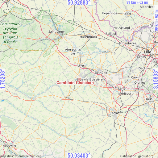
Camblain-Châtelain GPS coordinates[2]
50° 29' 0.78" North, 2° 27' 18.756" East
| Map corner | latitude | longitude |
|---|---|---|
| Upper-left | 50.92883°, | 1.75208° |
| Center: | 50.48355°, | 2.45521° |
| Lower-right: | 50.03403°, | 3.15833° |
| Map W x H: | 99.5×99.5 km | = 61.8×61.8mi |
| max Lat: | 51.07786° ⇑2.8% North |
| Camblain-Châtelain: | 50.48355° |
| min Lat: | ⇓97.2% South 41.3874° |
| min Long | Camblain-Châte | max Long |
| -5.08615° | 2.45521° | 9.52242° |
| W 49.9%⇐ | ⇒50.1% E |
Elevation
Elevation of Camblain-Châtelain is 64 m = 210 ft, and this is 129.7 m = 426 ft below average elevation for this country.
| Max E: |
2333 m = 7654 ft | 76.2% |
| Avg. | 193.7 m = 635 ft | |
| Camblain-Châtelain | 64 m = 210 ft | |
Min E: |
-1 m = -3 ft | 23.8% |
See also: France elevation on elevation.city.
Geographical zone
Camblain-Châtelain is located in North temperate zone (between Tropic of Cancer and the Arctic Circle). Distance of this North polar circle is 1787.9 km =1110.9 mi to North.| Distance of | km | miles | from Camblain-Châtelain |
|---|---|---|---|
| North Pole | 4393.8 | 2730.2 | to North |
| Arctic Circle | 1787.9 | 1110.9 | to North |
| Tropic Cancer | 3007.3 | 1868.6 | to South |
| Equator | 5613.2 | 3487.9 | to South |


Nearby cities:
15 places around Camblain-Châtelain: (largest is in red/bold)
• Allouagne
6.7 km =4.2 mi,  36°
36°
• Auchel
2.6 km =1.6 mi,  30°
30°
• Bours
4.7 km =2.9 mi,  224°
224°
• Burbure
6 km =3.7 mi,  9°
9°
• Calonne-Ricouart
1.3 km =0.8 mi,  82°
82°
• Cauchy-à-la-Tour
2.4 km =1.5 mi,  344°
344°
• Divion
3.8 km =2.4 mi,  110°
110°
• Diéval
5.4 km =3.4 mi,  183°
183°
• Ferfay
4.4 km =2.7 mi,  331°
331°
• Floringhem
2.5 km =1.6 mi,  303°
303°
• Lapugnoy
6.7 km =4.2 mi,  56°
56°
• Lozinghem
4.9 km =3 mi, 42°
• Marles-les-Mines
4.5 km =2.8 mi, 58°
• Ourton
3.5 km =2.2 mi,  148°
148°
• Pernes
3 km =1.9 mi,  271°
271°
Sources, notices
• [Note1] Compared only with cities in France existing in our database
• [Src1] Map data: © OpenStreetMap contributors (CC-BY-SA)
• [Src2] Other city data from geonames.org with taken over terms of usage.
• [Src3] Geographical zone / Annual Mean Temperature by Robert A. Rohde @ Wikipedia
