Oulchy-le-Château geodata
Oulchy-le-Château (Hauts-de-France) is a populated place; located in France in Europe/Paris (GMT+2) time zone. With population of 874 people, there are 9865 cities with bigger population in this country. Compared to other cities in France, 84.4% of cities are located further ↓South; 62.9% of cities are located further ←West and 55.2% of cities have higher elevation than Oulchy-le-Château. Note1
Administrative division(s):
- Level 1: Hauts-de-France
- Level 2: Département de l'Aisne
- Level 3: Arrondissement de Soissons
- Level 4: Oulchy-le-Château


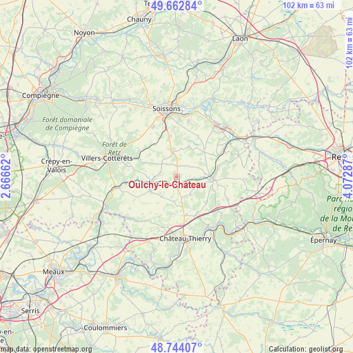
Oulchy-le-Château GPS coordinates[2]
49° 12' 20.124" North, 3° 22' 11.1" East
| Map corner | latitude | longitude |
|---|---|---|
| Upper-left | 49.66284°, | 2.66662° |
| Center: | 49.20559°, | 3.36975° |
| Lower-right: | 48.74407°, | 4.07287° |
| Map W x H: | 102.2×102.2 km | = 63.5×63.5mi |
| max Lat: | 51.07786° ⇑15.6% North |
| Oulchy-le-Château: | 49.20559° |
| min Lat: | ⇓84.4% South 41.3874° |
| min Long | Oulchy-le-Chât | max Long |
| -5.08615° | 3.36975° | 9.52242° |
| W 62.9%⇐ | ⇒37.1% E |
Elevation
Elevation of Oulchy-le-Château is 116 m = 381 ft, and this is 77.7 m = 255 ft below average elevation for this country.
| Max E: |
2333 m = 7654 ft | 55.2% |
| Avg. | 193.7 m = 635 ft | |
| Oulchy-le-Château | 116 m = 381 ft | |
Min E: |
-1 m = -3 ft | 44.8% |
See also: France elevation on elevation.city.
Geographical zone
Oulchy-le-Château is located in North temperate zone (between Tropic of Cancer and the Arctic Circle). Distance of this North polar circle is 1930 km =1199.2 mi to North.| Distance of | km | miles | from Oulchy-le-Château |
|---|---|---|---|
| North Pole | 4535.9 | 2818.5 | to North |
| Arctic Circle | 1930 | 1199.2 | to North |
| Tropic Cancer | 2865.2 | 1780.4 | to South |
| Equator | 5471.1 | 3399.6 | to South |


Nearby cities:
15 places around Oulchy-le-Château: (largest is in red/bold)
• Acy
15.8 km =9.8 mi,  11°
11°
• Belleu
17.3 km =10.7 mi,  351°
351°
• Beuvardes
11.2 km =7 mi,  129°
129°
• Billy-sur-Aisne
16.8 km =10.4 mi,  3°
3°
• Château-Thierry
17.9 km =11.1 mi,  172°
172°
• Coincy
6.3 km =3.9 mi,  142°
142°
• Courmelles
16.2 km =10.1 mi, 345°
• Fère-en-Tardenois
10.7 km =6.6 mi,  93°
93°
• Jaulgonne
17.7 km =11 mi, 137°
• La Ferté-Milon
17.8 km =11.1 mi,  258°
258°
• Mont-Saint-Père
16.9 km =10.5 mi,  149°
149°
• Neuilly-Saint-Front
8.6 km =5.3 mi,  242°
242°
• Septmonts
14.4 km =8.9 mi,  356°
356°
• Venizel
17.9 km =11.1 mi, 5°
• Épaux-Bézu
11 km =6.8 mi,  188°
188°
Sources, notices
• [Note1] Compared only with cities in France existing in our database
• [Src1] Map data: © OpenStreetMap contributors (CC-BY-SA)
• [Src2] Other city data from geonames.org with taken over terms of usage.
• [Src3] Geographical zone / Annual Mean Temperature by Robert A. Rohde @ Wikipedia
