Neuilly-Saint-Front geodata
Neuilly-Saint-Front (Hauts-de-France) is a populated place; located in France in Europe/Paris (GMT+2) time zone. With population of 2,103 people, there are 4586 cities with bigger population in this country. Compared to other cities in France, 83.7% of cities are located further ↓South; 61.5% of cities are located further ←West and 55.9% of cities have higher elevation than Neuilly-Saint-Front. Note1
Administrative division(s):
- Level 1: Hauts-de-France
- Level 2: Département de l'Aisne
- Level 3: Arrondissement de Château-Thierry
- Level 4: Neuilly-Saint-Front


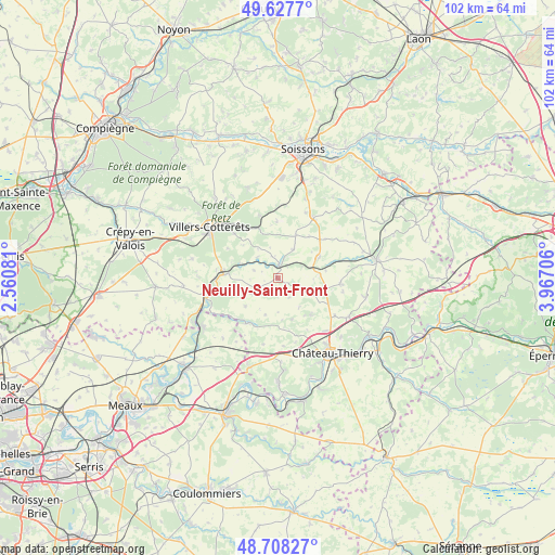
Neuilly-Saint-Front GPS coordinates[2]
49° 10' 12.432" North, 3° 15' 50.148" East
| Map corner | latitude | longitude |
|---|---|---|
| Upper-left | 49.6277°, | 2.56081° |
| Center: | 49.17012°, | 3.26393° |
| Lower-right: | 48.70827°, | 3.96706° |
| Map W x H: | 102.2×102.2 km | = 63.5×63.5mi |
| max Lat: | 51.07786° ⇑16.3% North |
| Neuilly-Saint-Front: | 49.17012° |
| min Lat: | ⇓83.7% South 41.3874° |
| min Long | Neuilly-Saint-F | max Long |
| -5.08615° | 3.26393° | 9.52242° |
| W 61.5%⇐ | ⇒38.5% E |
Elevation
Elevation of Neuilly-Saint-Front is 114 m = 374 ft, and this is 79.7 m = 261 ft below average elevation for this country.
| Max E: |
2333 m = 7654 ft | 55.9% |
| Avg. | 193.7 m = 635 ft | |
| Neuilly-Saint-Front | 114 m = 374 ft | |
Min E: |
-1 m = -3 ft | 44.1% |
See also: France elevation on elevation.city.
Geographical zone
Neuilly-Saint-Front is located in North temperate zone (between Tropic of Cancer and the Arctic Circle). Distance of this North polar circle is 1934 km =1201.7 mi to North.| Distance of | km | miles | from Neuilly-Saint-Front |
|---|---|---|---|
| North Pole | 4539.9 | 2821 | to North |
| Arctic Circle | 1934 | 1201.7 | to North |
| Tropic Cancer | 2861.3 | 1777.9 | to South |
| Equator | 5467.2 | 3397.2 | to South |


Nearby cities:
15 places around Neuilly-Saint-Front: (largest is in red/bold)
• Beuvardes
16.7 km =10.4 mi,  100°
100°
• Château-Thierry
17.1 km =10.6 mi,  143°
143°
• Coincy
11.5 km =7.1 mi, 95°
• Coulombs-en-Valois
14.9 km =9.3 mi,  219°
219°
• Crouy-sur-Ourcq
16.4 km =10.2 mi,  236°
236°
• Domptin
17.1 km =10.6 mi,  176°
176°
• Essômes-sur-Marne
17.7 km =11 mi,  152°
152°
• Gandelu
10.3 km =6.4 mi,  214°
214°
• La Ferté-Milon
9.8 km =6.1 mi,  272°
272°
• Mareuil-sur-Ourcq
14 km =8.7 mi,  254°
254°
• Marolles
11.6 km =7.2 mi, 270°
• Montreuil-aux-Lions
17.3 km =10.7 mi,  196°
196°
• Oulchy-le-Château
8.6 km =5.3 mi,  62°
62°
• Villers-Cotterêts
15.6 km =9.7 mi,  306°
306°
• Épaux-Bézu
9.3 km =5.8 mi, 138°
Sources, notices
• [Note1] Compared only with cities in France existing in our database
• [Src1] Map data: © OpenStreetMap contributors (CC-BY-SA)
• [Src2] Other city data from geonames.org with taken over terms of usage.
• [Src3] Geographical zone / Annual Mean Temperature by Robert A. Rohde @ Wikipedia
