Eschau geodata
Eschau (Grand Est) is a populated place; located in France in Europe/Paris (GMT+2) time zone. With population of 4,641 people, there are 2133 cities with bigger population in this country. Compared to other cities in France, 68.1% of cities are located further ↓South; 99.1% of cities are located further ←West and 53.3% of cities have lower elevation than Eschau. Note1
Administrative division(s):
- Level 1: Grand Est
- Level 2: Bas-Rhin
- Level 3: Arrondissement de Strasbourg
- Level 4: Eschau


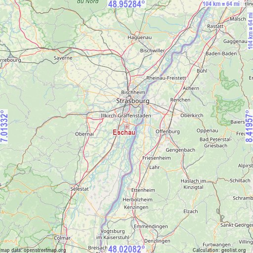
Eschau GPS coordinates[2]
48° 29' 20.292" North, 7° 42' 59.184" East
| Map corner | latitude | longitude |
|---|---|---|
| Upper-left | 48.95284°, | 7.01332° |
| Center: | 48.48897°, | 7.71644° |
| Lower-right: | 48.02082°, | 8.41957° |
| Map W x H: | 103.6×103.6 km | = 64.4×64.4mi |
| max Lat: | 51.07786° ⇑31.9% North |
| Eschau: | 48.48897° |
| min Lat: | ⇓68.1% South 41.3874° |
| min Long | Eschau | max Long |
| -5.08615° | 7.71644° | 9.52242° |
| W 99.1%⇐ | ⇒0.90000000000001% E |
Elevation
Elevation of Eschau is 144 m = 472 ft, and this is 49.7 m = 163 ft below average elevation for this country.
| Max E: |
2333 m = 7654 ft | 46.7% |
| Avg. | 193.7 m = 635 ft | |
| Eschau | 144 m = 472 ft | |
Min E: |
-1 m = -3 ft | 53.3% |
See also: France elevation on elevation.city.
Geographical zone
Eschau is located in North temperate zone (between Tropic of Cancer and the Arctic Circle). Distance of this North polar circle is 2009.7 km =1248.8 mi to North.| Distance of | km | miles | from Eschau |
|---|---|---|---|
| North Pole | 4615.6 | 2868 | to North |
| Arctic Circle | 2009.7 | 1248.8 | to North |
| Tropic Cancer | 2785.5 | 1730.8 | to South |
| Equator | 5391.5 | 3350.1 | to South |


Nearby cities:
15 places around Eschau: (largest is in red/bold)
• Blaesheim
8.1 km =5 mi,  283°
283°
• Entzheim
7.7 km =4.8 mi,  310°
310°
• Erstein
8.3 km =5.2 mi,  208°
208°
• Fegersheim
2.6 km =1.6 mi,  272°
272°
• Geispolsheim
5.9 km =3.7 mi,  300°
300°
• Hindisheim
6.2 km =3.9 mi,  248°
248°
• Hipsheim
3.9 km =2.4 mi,  230°
230°
• Holtzheim
9.4 km =5.8 mi,  325°
325°
• Illkirch-Graffenstaden
4.4 km =2.7 mi,  358°
358°
• Limersheim
6.5 km =4 mi, 234°
• Lingolsheim
8 km =5 mi,  341°
341°
• Lipsheim
3.6 km =2.2 mi, 274°
• Nordhouse
5.5 km =3.4 mi,  215°
215°
• Ostwald
6.1 km =3.8 mi, 356°
• Plobsheim
2.2 km =1.4 mi,  164°
164°
Sources, notices
• [Note1] Compared only with cities in France existing in our database
• [Src1] Map data: © OpenStreetMap contributors (CC-BY-SA)
• [Src2] Other city data from geonames.org with taken over terms of usage.
• [Src3] Geographical zone / Annual Mean Temperature by Robert A. Rohde @ Wikipedia
