Luc-la-Primaube geodata
Luc-la-Primaube (Occitanie) is a populated place; located in France in Europe/Paris (GMT+2) time zone. With population of 5,267 people, there are 1868 cities with bigger population in this country. Compared to other cities in France, 84.8% of cities are located further ↑North; 51.2% of cities are located further ←West and 96.5% of cities have lower elevation than Luc-la-Primaube. Note1
Administrative division(s):
- Level 1: Occitanie
- Level 2: Département de l'Aveyron
- Level 3: Arrondissement de Rodez
- Level 4: Luc-la-Primaube


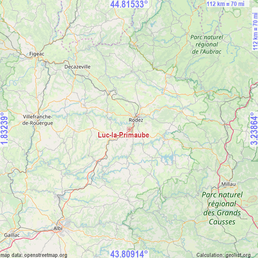
Luc-la-Primaube GPS coordinates[2]
44° 18' 51.804" North, 2° 32' 7.872" East
| Map corner | latitude | longitude |
|---|---|---|
| Upper-left | 44.81533°, | 1.83239° |
| Center: | 44.31439°, | 2.53552° |
| Lower-right: | 43.80914°, | 3.23864° |
| Map W x H: | 111.9×111.9 km | = 69.5×69.5mi |
| max Lat: | 51.07786° ⇑84.8% North |
| Luc-la-Primaube: | 44.31439° |
| min Lat: | ⇓15.2% South 41.3874° |
| min Long | Luc-la-Primaube | max Long |
| -5.08615° | 2.53552° | 9.52242° |
| W 51.2%⇐ | ⇒48.8% E |
Elevation
Elevation of Luc-la-Primaube is 681 m = 2234 ft, and this is 487.3 m = 1599 ft above average elevation for this country.
| Max E: |
2333 m = 7654 ft | 3.5% |
| Luc-la-Primaube | 681 m 2234 ft | |
| Avg. | 193.7 m = 635 ft | |
Min E: |
-1 m = -3 ft | 96.5% |
See also: France elevation on elevation.city.
Geographical zone
Luc-la-Primaube is located in North temperate zone (between Tropic of Cancer and the Arctic Circle). Distance of this Northern Tropic circle is 2321.4 km =1442.5 mi to South.| Distance of | km | miles | from Luc-la-Primaube |
|---|---|---|---|
| North Pole | 5079.8 | 3156.4 | to North |
| Arctic Circle | 2473.9 | 1537.2 | to North |
| Tropic Cancer | 2321.4 | 1442.5 | to South |
| Equator | 4927.3 | 3061.7 | to South |


Nearby cities:
15 places around Luc-la-Primaube: (largest is in red/bold)
• Balsac
12.2 km =7.6 mi,  324°
324°
• Baraqueville
9.3 km =5.8 mi,  242°
242°
• Calmont
7.5 km =4.7 mi,  194°
194°
• Druelle
5.6 km =3.5 mi,  334°
334°
• Flavin
6.2 km =3.9 mi,  117°
117°
• La Loubière
12.3 km =7.6 mi,  58°
58°
• Le Monastère
4.6 km =2.9 mi,  49°
49°
• Manhac
8.5 km =5.3 mi,  218°
218°
• Moyrazès
8.2 km =5.1 mi,  291°
291°
• Olemps
3.8 km =2.4 mi,  19°
19°
• Rodez
5.2 km =3.2 mi,  35°
35°
• Sainte-Radegonde
7.7 km =4.8 mi,  70°
70°
• Salles-la-Source
13.5 km =8.4 mi,  352°
352°
• Sébazac-Concourès
11.4 km =7.1 mi,  28°
28°
• Trémouilles
11.6 km =7.2 mi,  131°
131°
Sources, notices
• [Note1] Compared only with cities in France existing in our database
• [Src1] Map data: © OpenStreetMap contributors (CC-BY-SA)
• [Src2] Other city data from geonames.org with taken over terms of usage.
• [Src3] Geographical zone / Annual Mean Temperature by Robert A. Rohde @ Wikipedia
