Trémouilles geodata
Trémouilles (Occitanie) is a populated place; located in France in Europe/Paris (GMT+2) time zone. With population of 530 people, there are 14611 cities with bigger population in this country. Compared to other cities in France, 85.2% of cities are located further ↑North; 52.7% of cities are located further ←West and 97.9% of cities have lower elevation than Trémouilles. Note1
Administrative division(s):
- Level 1: Occitanie
- Level 2: Département de l'Aveyron
- Level 3: Arrondissement de Millau
- Level 4: Trémouilles


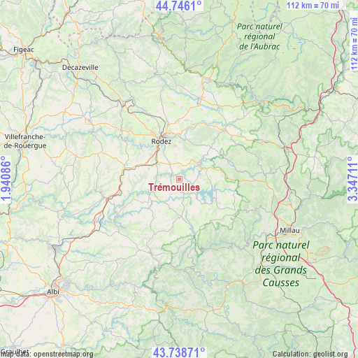
Trémouilles GPS coordinates[2]
44° 14' 40.416" North, 2° 38' 38.364" East
| Map corner | latitude | longitude |
|---|---|---|
| Upper-left | 44.7461°, | 1.94086° |
| Center: | 44.24456°, | 2.64399° |
| Lower-right: | 43.73871°, | 3.34711° |
| Map W x H: | 112×112 km | = 69.6×69.6mi |
| max Lat: | 51.07786° ⇑85.2% North |
| Trémouilles: | 44.24456° |
| min Lat: | ⇓14.8% South 41.3874° |
| min Long | Trémouilles | max Long |
| -5.08615° | 2.64399° | 9.52242° |
| W 52.7%⇐ | ⇒47.3% E |
Elevation
Elevation of Trémouilles is 814 m = 2671 ft, and this is 620.3 m = 2035 ft above average elevation for this country.
| Max E: |
2333 m = 7654 ft | 2.1% |
| Trémouilles | 814 m 2671 ft | |
| Avg. | 193.7 m = 635 ft | |
Min E: |
-1 m = -3 ft | 97.9% |
See also: France elevation on elevation.city.
Geographical zone
Trémouilles is located in North temperate zone (between Tropic of Cancer and the Arctic Circle). Distance of this Northern Tropic circle is 2313.6 km =1437.6 mi to South.| Distance of | km | miles | from Trémouilles |
|---|---|---|---|
| North Pole | 5087.5 | 3161.2 | to North |
| Arctic Circle | 2481.6 | 1542 | to North |
| Tropic Cancer | 2313.6 | 1437.6 | to South |
| Equator | 4919.5 | 3056.8 | to South |


Nearby cities:
15 places around Trémouilles: (largest is in red/bold)
• Arvieu
6 km =3.7 mi,  167°
167°
• Calmont
10.5 km =6.5 mi,  272°
272°
• Cassagnes-Bégonhès
12.3 km =7.6 mi,  227°
227°
• Durenque
15.2 km =9.4 mi,  187°
187°
• Flavin
5.8 km =3.6 mi,  327°
327°
• La Loubière
14.2 km =8.8 mi,  7°
7°
• Le Monastère
12 km =7.5 mi, 334°
• Luc-la-Primaube
11.6 km =7.2 mi,  311°
311°
• Manhac
14 km =8.7 mi, 274°
• Olemps
13.5 km =8.4 mi, 326°
• Pont-de-Salars
7.8 km =4.8 mi,  58°
58°
• Rodez
13.3 km =8.3 mi, 334°
• Sainte-Radegonde
10.4 km =6.5 mi,  352°
352°
• Salles-Curan
13.4 km =8.3 mi,  121°
121°
• Salmiech
9 km =5.6 mi,  218°
218°
Sources, notices
• [Note1] Compared only with cities in France existing in our database
• [Src1] Map data: © OpenStreetMap contributors (CC-BY-SA)
• [Src2] Other city data from geonames.org with taken over terms of usage.
• [Src3] Geographical zone / Annual Mean Temperature by Robert A. Rohde @ Wikipedia
