Oberhergheim geodata
Oberhergheim (Grand Est) is a populated place; located in France in Europe/Paris (GMT+2) time zone. With population of 1,149 people, there are 7828 cities with bigger population in this country. Compared to other cities in France, 58.7% of cities are located further ↓South; 97.2% of cities are located further ←West and 66.6% of cities have lower elevation than Oberhergheim. Note1
Administrative division(s):
- Level 1: Grand Est
- Level 2: Haut-Rhin
- Level 3: Arrondissement de Thann-Guebwiller
- Level 4: Oberhergheim


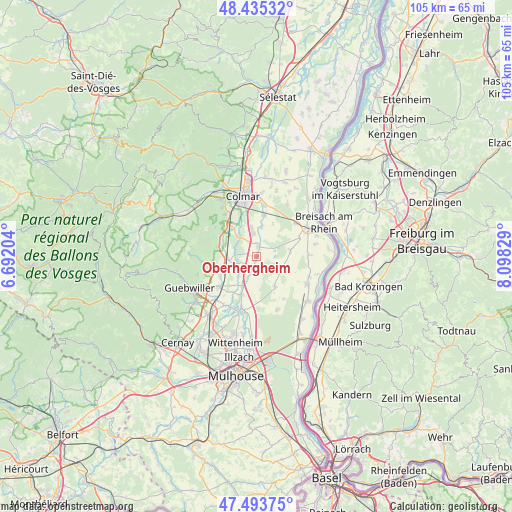
Oberhergheim GPS coordinates[2]
47° 58' 0.048" North, 7° 23' 42.576" East
| Map corner | latitude | longitude |
|---|---|---|
| Upper-left | 48.43532°, | 6.69204° |
| Center: | 47.96668°, | 7.39516° |
| Lower-right: | 47.49375°, | 8.09829° |
| Map W x H: | 104.7×104.7 km | = 65.1×65.1mi |
| max Lat: | 51.07786° ⇑41.3% North |
| Oberhergheim: | 47.96668° |
| min Lat: | ⇓58.7% South 41.3874° |
| min Long | Oberhergheim | max Long |
| -5.08615° | 7.39516° | 9.52242° |
| W 97.2%⇐ | ⇒2.8% E |
Elevation
Elevation of Oberhergheim is 202 m = 663 ft, and this is 8.3 m = 27 ft above average elevation for this country.
| Max E: |
2333 m = 7654 ft | 33.4% |
| Oberhergheim | 202 m 663 ft | |
| Avg. | 193.7 m = 635 ft | |
Min E: |
-1 m = -3 ft | 66.6% |
See also: France elevation on elevation.city.
Geographical zone
Oberhergheim is located in North temperate zone (between Tropic of Cancer and the Arctic Circle). Distance of this North polar circle is 2067.8 km =1284.9 mi to North.| Distance of | km | miles | from Oberhergheim |
|---|---|---|---|
| North Pole | 4673.7 | 2904.1 | to North |
| Arctic Circle | 2067.8 | 1284.9 | to North |
| Tropic Cancer | 2727.5 | 1694.8 | to South |
| Equator | 5333.4 | 3314 | to South |


Nearby cities:
15 places around Oberhergheim: (largest is in red/bold)
• Dessenheim
7.1 km =4.4 mi,  80°
80°
• Gundolsheim
8.5 km =5.3 mi,  241°
241°
• Hattstatt
8.6 km =5.3 mi,  305°
305°
• Herrlisheim-près-Colmar
7.7 km =4.8 mi,  318°
318°
• Hirtzfelden
7.2 km =4.5 mi,  148°
148°
• Logelheim
6 km =3.7 mi,  8°
8°
• Meyenheim
6.6 km =4.1 mi,  206°
206°
• Niederhergheim
2.1 km =1.3 mi,  4°
4°
• Oberentzen
3 km =1.9 mi, 208°
• Pfaffenheim
8.2 km =5.1 mi,  284°
284°
• Rouffach
7.1 km =4.4 mi,  262°
262°
• Rustenhart
5.7 km =3.5 mi,  119°
119°
• Réguisheim
8.5 km =5.3 mi,  201°
201°
• Sainte-Croix-en-Plaine
4.7 km =2.9 mi,  351°
351°
• Sundhoffen
8.6 km =5.3 mi, 9°
Sources, notices
• [Note1] Compared only with cities in France existing in our database
• [Src1] Map data: © OpenStreetMap contributors (CC-BY-SA)
• [Src2] Other city data from geonames.org with taken over terms of usage.
• [Src3] Geographical zone / Annual Mean Temperature by Robert A. Rohde @ Wikipedia
