Noirétable geodata
Noirétable (Auvergne-Rhône-Alpes) is a populated place; located in France in Europe/Paris (GMT+2) time zone. With population of 1,747 people, there are 5423 cities with bigger population in this country. Compared to other cities in France, 69% of cities are located further ↑North; 66.1% of cities are located further ←West and 96.9% of cities have lower elevation than Noirétable. Note1
Administrative division(s):
- Level 1: Auvergne-Rhône-Alpes
- Level 2: Département de la Loire
- Level 3: Arrondissement de Montbrison
- Level 4: Noirétable


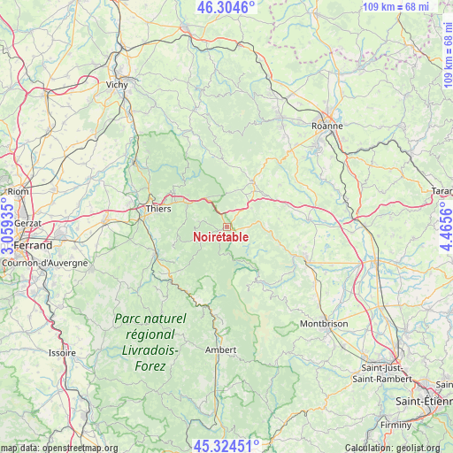
Noirétable GPS coordinates[2]
45° 49' 0.156" North, 3° 45' 44.892" East
| Map corner | latitude | longitude |
|---|---|---|
| Upper-left | 46.3046°, | 3.05935° |
| Center: | 45.81671°, | 3.76247° |
| Lower-right: | 45.32451°, | 4.4656° |
| Map W x H: | 109×109 km | = 67.7×67.7mi |
| max Lat: | 51.07786° ⇑69% North |
| Noirétable: | 45.81671° |
| min Lat: | ⇓31% South 41.3874° |
| min Long | Noirétable | max Long |
| -5.08615° | 3.76247° | 9.52242° |
| W 66.1%⇐ | ⇒33.9% E |
Elevation
Elevation of Noirétable is 718 m = 2356 ft, and this is 524.3 m = 1720 ft above average elevation for this country.
| Max E: |
2333 m = 7654 ft | 3.1% |
| Noirétable | 718 m 2356 ft | |
| Avg. | 193.7 m = 635 ft | |
Min E: |
-1 m = -3 ft | 96.9% |
See also: France elevation on elevation.city.
Geographical zone
Noirétable is located in North temperate zone (between Tropic of Cancer and the Arctic Circle). Distance of this North polar circle is 2306.8 km =1433.4 mi to North.| Distance of | km | miles | from Noirétable |
|---|---|---|---|
| North Pole | 4912.7 | 3052.6 | to North |
| Arctic Circle | 2306.8 | 1433.4 | to North |
| Tropic Cancer | 2488.4 | 1546.2 | to South |
| Equator | 5094.3 | 3165.5 | to South |


Nearby cities:
15 places around Noirétable: (largest is in red/bold)
• Arconsat
8.9 km =5.5 mi,  334°
334°
• Augerolles
15.4 km =9.6 mi,  227°
227°
• Celles-sur-Durolle
10.9 km =6.8 mi,  295°
295°
• Chabreloche
8.6 km =5.3 mi,  323°
323°
• Courpière
18.3 km =11.4 mi,  248°
248°
• Cremeaux
15.9 km =9.9 mi,  50°
50°
• Escoutoux
15.4 km =9.6 mi,  271°
271°
• La Monnerie-le-Montel
13.9 km =8.6 mi, 295°
• Palladuc
14.3 km =8.9 mi,  313°
313°
• Saint-Just-en-Chevalet
12.5 km =7.8 mi,  29°
29°
• Saint-Martin-la-Sauveté
12.5 km =7.8 mi,  81°
81°
• Saint-Rémy-sur-Durolle
15.4 km =9.6 mi, 301°
• Saint-Sixte
17.6 km =10.9 mi,  105°
105°
• Thiers
17.2 km =10.7 mi,  284°
284°
• Vollore-Ville
13 km =8.1 mi, 254°
Sources, notices
• [Note1] Compared only with cities in France existing in our database
• [Src1] Map data: © OpenStreetMap contributors (CC-BY-SA)
• [Src2] Other city data from geonames.org with taken over terms of usage.
• [Src3] Geographical zone / Annual Mean Temperature by Robert A. Rohde @ Wikipedia
