Nogent-le-Phaye geodata
Nogent-le-Phaye (Centre) is a populated place; located in France in Europe/Paris (GMT+2) time zone. With population of 1,247 people, there are 7299 cities with bigger population in this country. Compared to other cities in France, 67.1% of cities are located further ↓South; 62% of cities are located further →East and 52.5% of cities have lower elevation than Nogent-le-Phaye. Note1
Administrative division(s):
- Level 1: Centre
- Level 2: Département d'Eure-et-Loir
- Level 3: Arrondissement de Chartres
- Level 4: Nogent-le-Phaye


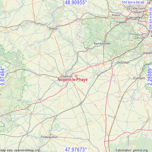
Nogent-le-Phaye GPS coordinates[2]
48° 26' 43.008" North, 1° 34' 39.972" East
| Map corner | latitude | longitude |
|---|---|---|
| Upper-left | 48.90955°, | 0.87464° |
| Center: | 48.44528°, | 1.57777° |
| Lower-right: | 47.97673°, | 2.28089° |
| Map W x H: | 103.7×103.7 km | = 64.4×64.4mi |
| max Lat: | 51.07786° ⇑32.9% North |
| Nogent-le-Phaye: | 48.44528° |
| min Lat: | ⇓67.1% South 41.3874° |
| min Long | Nogent-le-Phaye | max Long |
| -5.08615° | 1.57777° | 9.52242° |
| W 38%⇐ | ⇒62% E |
Elevation
Elevation of Nogent-le-Phaye is 141 m = 463 ft, and this is 52.7 m = 173 ft below average elevation for this country.
| Max E: |
2333 m = 7654 ft | 47.5% |
| Avg. | 193.7 m = 635 ft | |
| Nogent-le-Phaye | 141 m = 463 ft | |
Min E: |
-1 m = -3 ft | 52.5% |
See also: France elevation on elevation.city.
Geographical zone
Nogent-le-Phaye is located in North temperate zone (between Tropic of Cancer and the Arctic Circle). Distance of this North polar circle is 2014.6 km =1251.8 mi to North.| Distance of | km | miles | from Nogent-le-Phaye |
|---|---|---|---|
| North Pole | 4620.5 | 2871 | to North |
| Arctic Circle | 2014.6 | 1251.8 | to North |
| Tropic Cancer | 2780.7 | 1727.8 | to South |
| Equator | 5386.6 | 3347.1 | to South |


Nearby cities:
15 places around Nogent-le-Phaye: (largest is in red/bold)
• Barjouville
8.4 km =5.2 mi,  242°
242°
• Berchères-les-Pierres
6.9 km =4.3 mi,  194°
194°
• Champhol
6.1 km =3.8 mi,  294°
294°
• Chartres
6.5 km =4 mi,  271°
271°
• Coltainville
4.7 km =2.9 mi,  8°
8°
• Francourville
7.5 km =4.7 mi,  125°
125°
• Gasville-Oisème
4 km =2.5 mi,  313°
313°
• Jouy
7.6 km =4.7 mi,  341°
341°
• Le Coudray
6.3 km =3.9 mi, 244°
• Lucé
8.5 km =5.3 mi,  263°
263°
• Luisant
7.9 km =4.9 mi, 257°
• Lèves
7.6 km =4.7 mi, 291°
• Morancez
7.9 km =4.9 mi,  231°
231°
• Saint-Prest
6.2 km =3.9 mi,  325°
325°
• Sours
4.2 km =2.6 mi,  158°
158°
Sources, notices
• [Note1] Compared only with cities in France existing in our database
• [Src1] Map data: © OpenStreetMap contributors (CC-BY-SA)
• [Src2] Other city data from geonames.org with taken over terms of usage.
• [Src3] Geographical zone / Annual Mean Temperature by Robert A. Rohde @ Wikipedia
