Nassandres geodata
Nassandres (Normandy) is a populated place; located in France in Europe/Paris (GMT+2) time zone. With population of 1,468 people, there are 6303 cities with bigger population in this country. Compared to other cities in France, 82.8% of cities are located further ↓South; 71.1% of cities are located further →East and 72.3% of cities have higher elevation than Nassandres. Note1
Administrative division(s):
- Level 1: Normandy
- Level 2: Département de l'Eure
- Level 3: Arrondissement de Bernay
- Level 4: Nassandres sur Risle


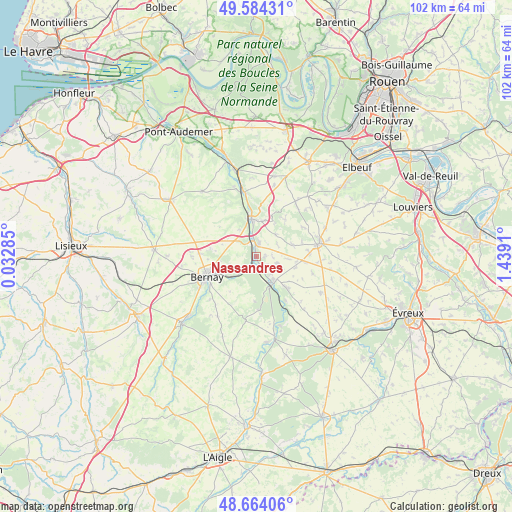
Nassandres GPS coordinates[2]
49° 7' 34.752" North, 0° 44' 9.492" East
| Map corner | latitude | longitude |
|---|---|---|
| Upper-left | 49.58431°, | 0.03285° |
| Center: | 49.12632°, | 0.73597° |
| Lower-right: | 48.66406°, | 1.4391° |
| Map W x H: | 102.3×102.3 km | = 63.6×63.6mi |
| max Lat: | 51.07786° ⇑17.2% North |
| Nassandres: | 49.12632° |
| min Lat: | ⇓82.8% South 41.3874° |
| min Long | Nassandres | max Long |
| -5.08615° | 0.73597° | 9.52242° |
| W 28.9%⇐ | ⇒71.1% E |
Elevation
Elevation of Nassandres is 73 m = 240 ft, and this is 120.7 m = 396 ft below average elevation for this country.
| Max E: |
2333 m = 7654 ft | 72.3% |
| Avg. | 193.7 m = 635 ft | |
| Nassandres | 73 m = 240 ft | |
Min E: |
-1 m = -3 ft | 27.7% |
See also: France elevation on elevation.city.
Geographical zone
Nassandres is located in North temperate zone (between Tropic of Cancer and the Arctic Circle). Distance of this North polar circle is 1938.8 km =1204.7 mi to North.| Distance of | km | miles | from Nassandres |
|---|---|---|---|
| North Pole | 4544.7 | 2823.9 | to North |
| Arctic Circle | 1938.8 | 1204.7 | to North |
| Tropic Cancer | 2856.4 | 1774.9 | to South |
| Equator | 5462.3 | 3394.1 | to South |


Nearby cities:
15 places around Nassandres: (largest is in red/bold)
• Barc
9 km =5.6 mi,  135°
135°
• Beaumont-le-Roger
6.2 km =3.9 mi,  148°
148°
• Beaumontel
5.2 km =3.2 mi,  158°
158°
• Bernay
10.8 km =6.7 mi,  247°
247°
• Brionne
7.8 km =4.8 mi,  348°
348°
• Calleville
7.4 km =4.6 mi,  12°
12°
• Combon
11.8 km =7.3 mi,  106°
106°
• Courbépine
12.7 km =7.9 mi,  270°
270°
• Goupillières
1.9 km =1.2 mi,  86°
86°
• Grosley-sur-Risle
10.2 km =6.3 mi, 151°
• Harcourt
5.8 km =3.6 mi,  38°
38°
• Menneval
9.2 km =5.7 mi, 251°
• Plasnes
8.3 km =5.2 mi,  277°
277°
• Saint-Aubin-le-Vertueux
12.5 km =7.8 mi,  228°
228°
• Serquigny
2.7 km =1.7 mi, 225°
Sources, notices
• [Note1] Compared only with cities in France existing in our database
• [Src1] Map data: © OpenStreetMap contributors (CC-BY-SA)
• [Src2] Other city data from geonames.org with taken over terms of usage.
• [Src3] Geographical zone / Annual Mean Temperature by Robert A. Rohde @ Wikipedia
