Beaumont-le-Roger geodata
Beaumont-le-Roger (Normandy) is a populated place; located in France in Europe/Paris (GMT+2) time zone. With population of 2,981 people, there are 3277 cities with bigger population in this country. Compared to other cities in France, 81.6% of cities are located further ↓South; 70.7% of cities are located further →East and 64.9% of cities have higher elevation than Beaumont-le-Roger. Note1
Administrative division(s):
- Level 1: Normandy
- Level 2: Département de l'Eure
- Level 3: Arrondissement de Bernay
- Level 4: Beaumont-le-Roger


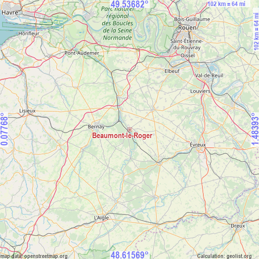
Beaumont-le-Roger GPS coordinates[2]
49° 4' 42.204" North, 0° 46' 50.916" East
| Map corner | latitude | longitude |
|---|---|---|
| Upper-left | 49.53682°, | 0.07768° |
| Center: | 49.07839°, | 0.78081° |
| Lower-right: | 48.61569°, | 1.48393° |
| Map W x H: | 102.4×102.4 km | = 63.6×63.6mi |
| max Lat: | 51.07786° ⇑18.4% North |
| Beaumont-le-Roger: | 49.07839° |
| min Lat: | ⇓81.6% South 41.3874° |
| min Long | Beaumont-le-Rog | max Long |
| -5.08615° | 0.78081° | 9.52242° |
| W 29.3%⇐ | ⇒70.7% E |
Elevation
Elevation of Beaumont-le-Roger is 90 m = 295 ft, and this is 103.7 m = 340 ft below average elevation for this country.
| Max E: |
2333 m = 7654 ft | 64.9% |
| Avg. | 193.7 m = 635 ft | |
| Beaumont-le-Roger | 90 m = 295 ft | |
Min E: |
-1 m = -3 ft | 35.1% |
See also: France elevation on elevation.city.
Geographical zone
Beaumont-le-Roger is located in North temperate zone (between Tropic of Cancer and the Arctic Circle). Distance of this North polar circle is 1944.2 km =1208.1 mi to North.| Distance of | km | miles | from Beaumont-le-Roger |
|---|---|---|---|
| North Pole | 4550.1 | 2827.3 | to North |
| Arctic Circle | 1944.2 | 1208.1 | to North |
| Tropic Cancer | 2851.1 | 1771.6 | to South |
| Equator | 5457 | 3390.8 | to South |


Nearby cities:
15 places around Beaumont-le-Roger: (largest is in red/bold)
• Barc
3.2 km =2 mi,  109°
109°
• Beaumesnil
9.3 km =5.8 mi,  216°
216°
• Beaumontel
1.4 km =0.9 mi,  290°
290°
• Bernay
13.3 km =8.3 mi,  275°
275°
• Calleville
12.7 km =7.9 mi,  352°
352°
• Combon
8.3 km =5.2 mi,  76°
76°
• Goupillières
5.6 km =3.5 mi, 345°
• Grosley-sur-Risle
4 km =2.5 mi,  156°
156°
• Harcourt
9.9 km =6.2 mi,  1°
1°
• Le Neubourg
12.4 km =7.7 mi,  49°
49°
• Menneval
12.2 km =7.6 mi, 281°
• Nassandres
6.2 km =3.9 mi,  328°
328°
• Plasnes
13.2 km =8.2 mi,  299°
299°
• Saint-Aubin-le-Vertueux
13 km =8.1 mi,  256°
256°
• Serquigny
6.2 km =3.9 mi, 303°
Sources, notices
• [Note1] Compared only with cities in France existing in our database
• [Src1] Map data: © OpenStreetMap contributors (CC-BY-SA)
• [Src2] Other city data from geonames.org with taken over terms of usage.
• [Src3] Geographical zone / Annual Mean Temperature by Robert A. Rohde @ Wikipedia
