Bernay geodata
Bernay (Normandy) is a seat of a third-order administrative division; located in France in Europe/Paris (GMT+2) time zone. With population of 12,399 people, there are 770 cities with bigger population in this country. Compared to other cities in France, 81.9% of cities are located further ↓South; 72.4% of cities are located further →East and 56.2% of cities have higher elevation than Bernay. Note1
Administrative division(s):
- Level 1: Normandy
- Level 2: Département de l'Eure
- Level 3: Arrondissement de Bernay
- Level 4: Bernay


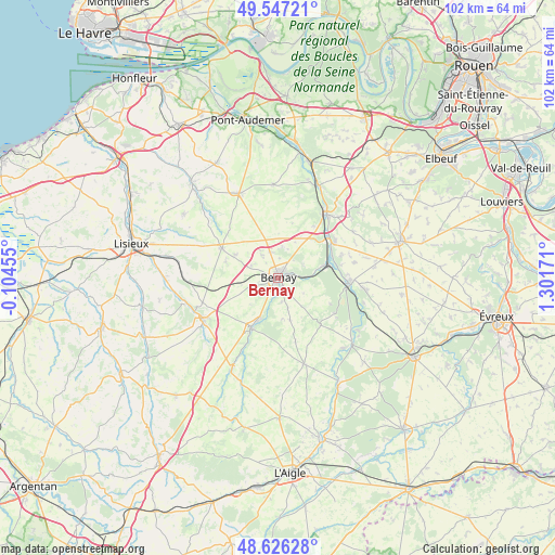
Bernay GPS coordinates[2]
49° 5' 19.968" North, 0° 35' 54.888" East
| Map corner | latitude | longitude |
|---|---|---|
| Upper-left | 49.54721°, | -0.10455° |
| Center: | 49.08888°, | 0.59858° |
| Lower-right: | 48.62628°, | 1.30171° |
| Map W x H: | 102.4×102.4 km | = 63.6×63.6mi |
| max Lat: | 51.07786° ⇑18.1% North |
| Bernay: | 49.08888° |
| min Lat: | ⇓81.9% South 41.3874° |
| min Long | Bernay | max Long |
| -5.08615° | 0.59858° | 9.52242° |
| W 27.6%⇐ | ⇒72.4% E |
Elevation
Elevation of Bernay is 113 m = 371 ft, and this is 80.7 m = 265 ft below average elevation for this country.
| Max E: |
2333 m = 7654 ft | 56.2% |
| Avg. | 193.7 m = 635 ft | |
| Bernay | 113 m = 371 ft | |
Min E: |
-1 m = -3 ft | 43.8% |
See also: France elevation on elevation.city.
Geographical zone
Bernay is located in North temperate zone (between Tropic of Cancer and the Arctic Circle). Distance of this North polar circle is 1943 km =1207.3 mi to North.| Distance of | km | miles | from Bernay |
|---|---|---|---|
| North Pole | 4548.9 | 2826.6 | to North |
| Arctic Circle | 1943 | 1207.3 | to North |
| Tropic Cancer | 2852.3 | 1772.3 | to South |
| Equator | 5458.2 | 3391.6 | to South |


Nearby cities:
15 places around Bernay: (largest is in red/bold)
• Beaumesnil
11.6 km =7.2 mi,  137°
137°
• Beaumont-le-Roger
13.3 km =8.3 mi,  95°
95°
• Beaumontel
11.9 km =7.4 mi,  93°
93°
• Brionne
14.6 km =9.1 mi,  35°
35°
• Broglie
10.2 km =6.3 mi,  209°
209°
• Caorches-Saint-Nicolas
3.6 km =2.2 mi,  260°
260°
• Courbépine
5 km =3.1 mi,  327°
327°
• Drucourt
10.1 km =6.3 mi,  287°
287°
• Goupillières
12.6 km =7.8 mi,  70°
70°
• Menneval
1.8 km =1.1 mi,  46°
46°
• Nassandres
10.8 km =6.7 mi, 67°
• Plasnes
5.6 km =3.5 mi,  18°
18°
• Saint-Aubin-le-Vertueux
4.2 km =2.6 mi,  171°
171°
• Serquigny
8.4 km =5.2 mi, 74°
• Thiberville
11.8 km =7.3 mi,  297°
297°
Sources, notices
• [Note1] Compared only with cities in France existing in our database
• [Src1] Map data: © OpenStreetMap contributors (CC-BY-SA)
• [Src2] Other city data from geonames.org with taken over terms of usage.
• [Src3] Geographical zone / Annual Mean Temperature by Robert A. Rohde @ Wikipedia
