Nandax geodata
Nandax (Auvergne-Rhône-Alpes) is a populated place; located in France in Europe/Paris (GMT+2) time zone. With population of 644 people, there are 12610 cities with bigger population in this country. Compared to other cities in France, 65.1% of cities are located further ↑North; 69.4% of cities are located further ←West and 83% of cities have lower elevation than Nandax. Note1
Administrative division(s):
- Level 1: Auvergne-Rhône-Alpes
- Level 2: Département de la Loire
- Level 3: Arrondissement de Roanne
- Level 4: Nandax


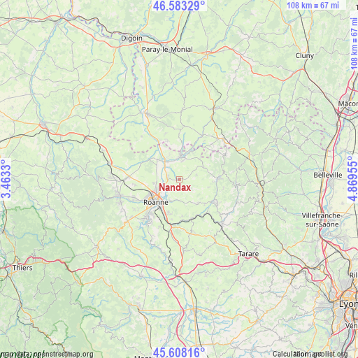
Nandax GPS coordinates[2]
46° 5' 52.368" North, 4° 9' 59.148" East
| Map corner | latitude | longitude |
|---|---|---|
| Upper-left | 46.58329°, | 3.4633° |
| Center: | 46.09788°, | 4.16643° |
| Lower-right: | 45.60816°, | 4.86955° |
| Map W x H: | 108.4×108.4 km | = 67.4×67.4mi |
| max Lat: | 51.07786° ⇑65.1% North |
| Nandax: | 46.09788° |
| min Lat: | ⇓34.9% South 41.3874° |
| min Long | Nandax | max Long |
| -5.08615° | 4.16643° | 9.52242° |
| W 69.4%⇐ | ⇒30.6% E |
Elevation
Elevation of Nandax is 321 m = 1053 ft, and this is 127.3 m = 418 ft above average elevation for this country.
| Max E: |
2333 m = 7654 ft | 17% |
| Nandax | 321 m 1053 ft | |
| Avg. | 193.7 m = 635 ft | |
Min E: |
-1 m = -3 ft | 83% |
See also: France elevation on elevation.city.
Geographical zone
Nandax is located in North temperate zone (between Tropic of Cancer and the Arctic Circle). Distance of this North polar circle is 2275.6 km =1414 mi to North.| Distance of | km | miles | from Nandax |
|---|---|---|---|
| North Pole | 4881.5 | 3033.2 | to North |
| Arctic Circle | 2275.6 | 1414 | to North |
| Tropic Cancer | 2519.7 | 1565.7 | to South |
| Equator | 5125.6 | 3184.9 | to South |


Nearby cities:
15 places around Nandax: (largest is in red/bold)
• Briennon
9.1 km =5.7 mi,  310°
310°
• Chandon
6.8 km =4.2 mi,  32°
32°
• Charlieu
7.1 km =4.4 mi,  3°
3°
• Coutouvre
4.1 km =2.5 mi,  132°
132°
• Cuinzier
8.5 km =5.3 mi,  67°
67°
• La Gresle
9.4 km =5.8 mi,  104°
104°
• Mably
9 km =5.6 mi,  245°
245°
• Mars
8.6 km =5.3 mi,  44°
44°
• Perreux
7.1 km =4.4 mi,  205°
205°
• Pouilly-sous-Charlieu
6.7 km =4.2 mi,  322°
322°
• Saint-Denis-de-Cabanne
9.1 km =5.7 mi,  24°
24°
• Saint-Nizier-sous-Charlieu
6.9 km =4.3 mi,  331°
331°
• Sevelinges
10 km =6.2 mi,  89°
89°
• Villers
5 km =3.1 mi,  58°
58°
• Vougy
3.8 km =2.4 mi,  280°
280°
Sources, notices
• [Note1] Compared only with cities in France existing in our database
• [Src1] Map data: © OpenStreetMap contributors (CC-BY-SA)
• [Src2] Other city data from geonames.org with taken over terms of usage.
• [Src3] Geographical zone / Annual Mean Temperature by Robert A. Rohde @ Wikipedia
